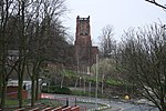
Cradley Heath

Cradley Heath is a town in the Rowley Regis area of the Metropolitan Borough of Sandwell, West Midlands, England approximately 2 miles (3 km) north-west of Halesowen, 3 miles (5 km) south of Dudley and 8 miles (13 km) west of central Birmingham. Cradley Heath is often confused with the neighbouring Halesowen district of Cradley from which it is separated by the River Stour; both are in the Black Country but have long been administered by different local authorities, and until 1966 were in separate counties. Cradley Heath is one of several towns in central England still recognisable from their early 20th-century appearance. Many of the shops and houses in the High Street are still standing after 100 years, though some were demolished in the mid-2000s to make way for a bypass, to ease congestion in the town centre.
Excerpt from the Wikipedia article Cradley Heath (License: CC BY-SA 3.0, Authors, Images).Cradley Heath
Corngreaves Road, Sandwell
Geographical coordinates (GPS) Address Nearby Places Show on map
Geographical coordinates (GPS)
| Latitude | Longitude |
|---|---|
| N 52.47302 ° | E -2.07908 ° |
Address
Four Ways Baptist Church
Corngreaves Road
B64 6BL Sandwell
England, United Kingdom
Open on Google Maps


