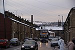
Matley
Areas of Greater ManchesterGeography of TamesideGreater Manchester geography stubsTowns and villages of the Peak District

Matley is a semi-rural area of Greater Manchester, England, between Stalybridge, Hyde and Dukinfield. Matley was a township of Mottram in Longdendale, one of the eight ancient parishes of the Macclesfield Hundred of Cheshire. Under the Poor Law Amendment Act 1886 the township became a civil parish in its own right. Between 1894 and 1936, Matley was a civil parish in the Tintwistle Rural District of Cheshire. The parish was abolished in 1936 and divided between the municipal boroughs of Stalybridge, Hyde and Dukinfield. In 1974, these boroughs were abolished and the area transferred to Greater Manchester to form part of the Metropolitan Borough of Tameside.
Excerpt from the Wikipedia article Matley (License: CC BY-SA 3.0, Authors, Images).Matley
Matley Park Lane, Tameside Matley
Geographical coordinates (GPS) Address Nearby Places Show on map
Geographical coordinates (GPS)
| Latitude | Longitude |
|---|---|
| N 53.4677 ° | E -2.0325 ° |
Address
Matley Park Lane
Matley Park Lane
SK15 2TL Tameside, Matley
England, United Kingdom
Open on Google Maps


