place

St Cuthbert's Church, Dufton

Church of England church buildings in CumbriaDiocese of CarlisleDuftonGrade II listed churches in Cumbria
St Cuthbert's Church, Dufton

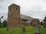
St Cuthbert's Church is situated 3⁄4 mile (1.2 km) north of the village of Dufton, Cumbria, England. It should not be confused with the nearby St Cuthbert's church, Milburn. It is an active Anglican parish church in the deanery of Appleby, the archdeaconry of Carlisle, and the diocese of Carlisle. The parish is one of ten parishes which form the benefice of the Heart of Eden.The Parish Church of St Cuthbert, Dufton, is situated north-west of the village of Dufton – the name of which means 'dove farm' – and nestles beneath the eastern fells above the Eden Valley, about 3 miles (4.8 km) north of Appleby and 12 miles (19 km) south-east of Penrith. From the new churchyard, fine views are to be had of Dufton Pike and the Pennines.

Excerpt from the Wikipedia article St Cuthbert's Church, Dufton (License: CC BY-SA 3.0, Authors, Images).

St Cuthbert's Church, Dufton
Hurning Lane,

Geographical coordinates (GPS) Address Nearby Places
placeShow on map

Wikipedia: St Cuthbert's Church, DuftonContinue reading on Wikipedia

Geographical coordinates (GPS)

Latitude Longitude
N 54.6299 ° E -2.4897 °
placeShow on map

Address

Hurning Lane
CA16 6DA
England, United Kingdom
mapOpen on Google Maps

St Cuthbert's Church, Dufton
Share experience

Nearby Places

Milburn, Cumbria
Milburn, Cumbria

Milburn is a small village and civil parish in the Eden district of Cumbria, England. It is located on the northern side of the Eden Valley, about 9 miles (14.5 km) east of Penrith. The parish had a population of 171 in both the 2001, and 2011 censuses.It lies beneath Cross Fell, the highest point of the Pennines and is one of a chain of villages following the 200 metres (660 ft) contour of the escarpment. The fellside forms part of the North Pennines Area of Natural Beauty which in 2003 was awarded the status of UNESCO European Geopark and includes the Moorhouse Upper Teesdale National Nature Reserve. The parish includes the outlying hamlets of Gullom Holme and Milburn Grange, respectively 0.5 miles (0.8 km) and 1.25 miles (2.0 km) from Milburn village centre. The core village consists of a tight cluster of houses, many dating from the mid-18th century, ranged around a roughly rectangular green. A medieval church and a fortified manor house lie outside the main village area. In 2006 the total population of the parish was approximately 170, representing a total of 74 households. Agriculture still provided the single most significant source of employment and this accounted for approximately 25% of the employment of the working population. A number of businesses offering professional and construction services now operate in the village, and local non-agricultural work accounted for the employment of a further 20%. The remaining 55% commuted out of the village to their employment. Of the total population, 30% were retired. The village retains its primary school though the majority of the pupils now come from outside the parish.