place

Sergeants Orchard

Essex Wildlife Trust
Sergeants Orchard old orchard 1

Sergeants Orchard is a 3.2-hectare (7.9-acre) nature reserve in Mount Bures and north of Chappel in Essex. It is owned and managed by the Essex Wildlife Trust.The site was left to the Trust by the owner of Sergeants Farm in 1995. It consists of an old orchard in a long narrow field, another narrow field to the west and a larger one to the east. The western field has been planted with fruit trees and the eastern one with a conservation grass mix. A rare bee, Bombus muscorum, has been found on the site.There is access from a footpath between Fordham Road and Balls Chace

Excerpt from the Wikipedia article Sergeants Orchard (License: CC BY-SA 3.0, Authors, Images).

Sergeants Orchard
Ball's Chace, Colchester

Geographical coordinates (GPS) Address Nearby Places
placeShow on map

Wikipedia: Sergeants OrchardContinue reading on Wikipedia

Geographical coordinates (GPS)

Latitude Longitude
N 51.943 ° E 0.775 °
placeShow on map

Address

Ball's Chace

Ball's Chace
CO6 2AR Colchester
England, United Kingdom
mapOpen on Google Maps

Sergeants Orchard old orchard 1
Share experience

Nearby Places

East Anglian Railway Museum

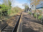
The East Anglian Railway Museum is located at Chappel and Wakes Colne railway station in Essex, England, which is situated on the former Great Eastern Railway branch line from Marks Tey to Sudbury. Services on the Sudbury Branch Line are operated by Abellio Greater Anglia. The museum has a wide collection of locomotives and rolling stock, some of which are fully restored, three are converted into Thomas, Percy and Toby replicas while others are undergoing repair and restoration. The Restoration Shed was built in 1983–4, before which most work had to take place in the Goods Shed or in the open. On event days, steam or diesel train rides are operated over a short demonstration track. The museum also plays host to two popular annual events: the Winter Beer Festival held in late February / early March (Timing depends on UK School Holidays), and the Summer Beer Festival held each September. During the festivals, additional late-evening trains on the Sudbury Branch Line allow festival-goers to return home by train subject to provision by the train operation companies. There are no moving exhibits during the festivals, although train carriages are usually open to sit in and drink, with one wagon doubling up as The Shunters Arms at the summer festival. In addition many other event days happen during the year, such as Classic Car rallies, Forties and Fifties day events, SteamPunk fairs, Model Railway events, Plays and musical performances and the ever popular "Days out with Thomas" events featuring Thomas The Tank Engine.

Bures Hamlet

Bures Hamlet is a civil parish in the Braintree district of Essex, England. At the 2011 census, it had a population of 749.The parish covers the western part of the village of Bures, the eastern part being in the Bures St. Mary parish in Suffolk. It also includes Daw's Cross. Bures railway station is in the parish. The civil parish of Bures Hamlet rises from the west bank of the River Stour, in the county of Essex – the ancient Kingdom of the East Saxons, although it remains in the ecclesiastical parish of Bures St. Mary, Suffolk – land of the South Folk of the East Angles. This anomaly was first recorded in the footnotes to the Domesday Book of 1086 which correct the allocation of Bures lands between the counties. The most populated part of the parish is the Hamlet itself, which flanks the river between the 20m and 25m (65’ and 81’) contour lines. Named when no more than a few scattered cottages, the Hamlet now rivals its parent Parish in size, with a population of some 765 people. The rest of the parish of Bures Hamlet is undulating agricultural land with scattered patches of woodland, some being remnants of the ancient forest and later deer parks. Much of the parish lies between the valleys of the River Stour and Cambridge Brook. There are no other major settlements, but a few clusters of cottages by ancient greens and crossroads, and some isolated farms. The highest point in the parish is on the southwest corner of the parish boundary at 73m (237’). There are wide views into the Stour Valley from many parts of the parish. An extensive network of public rights-of-Way provides off-road access to many parts of the parish. In addition, minor lanes that are relatively traffic-free intersect much of the parish, and while care must be taken in case vehicles are using the often winding and high-banked lanes, these can combine well with paths and bridleways to provide round and linear routes.