Bettel, Luxembourg
Luxembourg geography stubsTandelVillages in Luxembourg

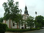
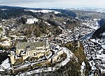
Bettel (Luxembourgish: Bëttel) is a village in the commune of Tandel, in north-eastern Luxembourg. As of 2001, the village had a population of 207. Until 1 January 2006, Bettel was part of the commune of Fouhren, which was merged with the commune of Bastendorf to form the modern commune of Tandel. Bettel is situated on the river Our, just opposite the German border and the village of Roth an der Our.
Excerpt from the Wikipedia article Bettel, Luxembourg (License: CC BY-SA 3.0, Authors, Images).Bettel, Luxembourg
K 5, Südeifel
Geographical coordinates (GPS) Address Nearby Places Show on map
Geographical coordinates (GPS)
| Latitude | Longitude |
|---|---|
| N 49.916666666667 ° | E 6.2333333333333 ° |
Address
K 5
54675 Südeifel
Rhineland-Palatinate, Germany
Open on Google Maps


