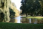
Watergraafsmeer
Amsterdam-OostFormer boroughs of AmsterdamFormer municipalities of North HollandNeighbourhoods of AmsterdamNorth Holland geography stubs ... and 1 more
Polders of North Holland

The Watergraafsmeer is a polder in the Netherlands. It was reclaimed in 1629. In the 17th and 18th centuries, there were many buitenplaatsen in the Watergraafsmeer, though nowadays only one, Frankendael, remains. Since 1921, the Watergraafsmeer is part of the city of Amsterdam and its rural character has all but disappeared. It is located in the borough of Amsterdam-Oost. The most important streets in the Watergraafsmeer are the Middenweg and the Kruislaan.
Excerpt from the Wikipedia article Watergraafsmeer (License: CC BY-SA 3.0, Authors, Images).Watergraafsmeer
Hugo de Vrieslaan, Amsterdam Oost
Geographical coordinates (GPS) Address Nearby Places Show on map
Geographical coordinates (GPS)
| Latitude | Longitude |
|---|---|
| N 52.35 ° | E 4.9333333333333 ° |
Address
Middenweg
Hugo de Vrieslaan
1097 EH Amsterdam, Oost
North Holland, Netherlands
Open on Google Maps


