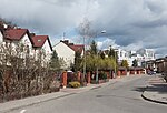
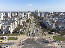
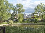
Wąwozowa Street, Warsaw

The Wąwozowa Street (Polish: Ulica Wąwozowa) is one of the principal streets of the Warsaw's residential neighborhood of Kabaty in the Ursynów district. It runs along the East-West axis, linking the Rosoła Street with the Stryjeńskich Street. The name comes from gorges (Polish: wąwozy) bordering escarpment of the Vistula, and was given in 1978 by the National Council of the Capital City of Warsaw resolution.The street was charted in 1980s during the development of Kabaty. Since 1995, the Kabaty metro station has been located beneath the street. There are two traffic lights – first one on the junction with the Komisji Edukacji Narodowej Avenue, and the second one with the Jerzy Zaruba Street (Polish: Ulica Jerzego Zaruby).There is a cycle path along the road.
Excerpt from the Wikipedia article Wąwozowa Street, Warsaw (License: CC BY-SA 3.0, Authors, Images).Wąwozowa Street, Warsaw
Wąwozowa, Warsaw Ursynów
Geographical coordinates (GPS) Address Nearby Places Show on map
Geographical coordinates (GPS)
| Latitude | Longitude |
|---|---|
| N 52.1312 ° | E 21.0657 ° |
Address
Wąwozowa 17
02-796 Warsaw, Ursynów
Masovian Voivodeship, Poland
Open on Google Maps


