Whitton, Powys
Powys geography stubsVillages in Powys

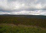
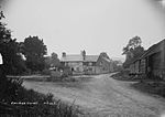
Whitton (Welsh: Llanddewi-yn-Hwytyn) is a village and a community in Radnorshire, Powys, Wales. It is located on the B4356 road 4 miles (6.4 km) south of Knighton. Hamlets in the community include Rhos-y-meirch and Pilleth. The community's population in 2011 was 348. St Mary's church is a grade II* listed building.The community is part of the Llangunllo electoral ward for elections to Powys County Council.
Excerpt from the Wikipedia article Whitton, Powys (License: CC BY-SA 3.0, Authors, Images).Whitton, Powys
B4356,
Geographical coordinates (GPS) Address Nearby Places Show on map
Geographical coordinates (GPS)
| Latitude | Longitude |
|---|---|
| N 52.3068 ° | E -3.0909 ° |
Address
B4356
LD7 1NR , Whitton
Wales, United Kingdom
Open on Google Maps


