place

Fruitlands Museum

1914 establishments in MassachusettsArt museums and galleries in MassachusettsBuildings and structures in Harvard, MassachusettsCommons category link is locally definedHistoric districts in Worcester County, Massachusetts
Historic house museums in MassachusettsHouses in Worcester County, MassachusettsMuseums in Worcester County, MassachusettsNRHP infobox with nocatNational Register of Historic Places in Worcester County, MassachusettsNative American museums in MassachusettsOpen-air museums in MassachusettsShaker communities or museumsShingle Style architecture in MassachusettsThe Trustees of Reservations
Fruitlands Museum buildings 1

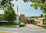
Fruitlands Museum in Harvard, Massachusetts, is a museum about multiple visions of America on the site of the short-lived utopian community, Fruitlands. The museum includes the Fruitlands farmhouse (a National Historic Landmark), a museum about Shaker life, an art gallery with 19th-century landscape paintings, vernacular American portraits, and other changing exhibitions, and a museum of Native American history. In 2023, readers of USA Today voted to name Fruitlands as one of the ten best history museums in the United States.Visitors can tour the farmhouse, which has been restored to appear as it did during the 1840s, and exhibits about Transcendentalism and the Alcott family. Fruitlands offers a diverse schedule of contemporary exhibits, lectures, outdoor concerts and easy walking trails. There is also a museum store and restaurant. The properties are overseen by The Trustees of Reservations.

Excerpt from the Wikipedia article Fruitlands Museum (License: CC BY-SA 3.0, Authors, Images).

Fruitlands Museum
Still River Road,

Geographical coordinates (GPS) Address Nearby Places
placeShow on map

Wikipedia: Fruitlands MuseumContinue reading on Wikipedia

Geographical coordinates (GPS)

Latitude Longitude
N 42.493611111111 ° E -71.613055555556 °
placeShow on map

Address

Still River Road 175
01467
Massachusetts, United States
mapOpen on Google Maps

Fruitlands Museum buildings 1
Share experience

Nearby Places

Bolton Flats Wildlife Management Area

Bolton Flats Wildlife Management Area is a 455-acre wildlife management area surrounding the Nashua River and Still River in Massachusetts. The Bolton Flats Wildlife Management Area is located in the towns of Bolton, Lancaster and Harvard, and Route 117 crosses through the area. Bolton Flats is a flood plain that was originally named "Intervale" because it is located in a valley between several hills. Birding, canoeing, fishing, hiking and hunting are popular in the area. Various turtles, including the endangered blanding turtle, and rare nesting birds are found in the habitat, and downstream from Bolton Flats is the Oxbow National Wildlife Refuge and Fort Devens Military Reservation.According to Massachusetts Department of Conservation and Recreation, "[t]he flat lowland between the Nashua River and the Still River is called Bolton Flats and is the result of the receded glacial Lake Nashua. The area is protected by the Commonwealth as the Bolton Flats Wildlife Management Area, which is in Harvard, Bolton and Lancaster. At the Bolton entrance to the Bolton Flats Management Area there is a modest early 20th century cape with a gambrel roof barn, owned by the state." The Still River area contains various Native American objects and was the site of brickmaking from colonial times into the nineteenth century. Several nearby brick houses, including the Haynes House (ca. 1820) at 304 Still River Road, were likely constructed using bricks from the Haynes Brickyard on the Still River.

Harvard Center Historic District

The Harvard Center Historic District is a historic district encompassing the traditional village center of Harvard, Massachusetts, USA. The district is centered on the town common, a triangular grassy space bounded by Elm Street, Still River Road, and Ayer Road. The common is ringed by residences, civic and religious buildings, and a small commercial area. The common was laid out when the town was founded in 1732, and has grown, mainly in periods of growth at the late 18th and late 19th/early 20th centuries. Most of the village's buildings post-date 1831. The district was added to the National Register of Historic Places in 1997.The historic district is roughly cruciform in shape, radiating out from the common along Still River Road (west), Massachusetts Avenue (Massachusetts Route 111) to the north and south, and Oak Hill Road and Old Littleton Road to the east. It covers about 125 acres (51 ha), and includes 59 historically significant houses, that range in architectural styles and age from the 18th to 20th centuries. The main civic buildings are located at the northern end of the common, and include a stone animal pound, a small powder house, and the 1872 Gothic Revival town hall, which stands next to an older (1828) Greek Revival frame building, now a residence, that also served as town hall.The district is home to two church buildings: the 1867 Colonial Revival First Congregational Church, set on the location of the town's first colonial meeting house, and the 1840 Methodist meeting house, now a private residence at 13 Massachusetts Avenue. Two of its architecturally most sophisticated buildings are the Bromfield School (1878, Romanesque Revival) designed by Peabody & Stearns, and the public library (1886, also Romanesque) designed by William Channing Whitney.