Vinkenbuurt
OmmenOverijssel geography stubsPopulated places in Overijssel

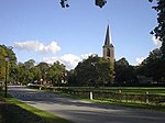
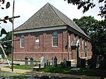
Vinkenbuurt is a hamlet in the Dutch province of Overijssel. It is part of the municipality of Ommen, and lies about 18 km south of Hoogeveen. It was first mentioned in 1867 as Vinkenbuurt. The romantic explanation is "neighbourhood with chaffinchs" or it might mean "neighbourhood with bad peat". In 1927, a church was constructed, and given its population, it could qualify as a village, but probably remained a hamlet due its spread out farms.
Excerpt from the Wikipedia article Vinkenbuurt (License: CC BY-SA 3.0, Authors, Images).Vinkenbuurt
Koloniedijk, Vinkenbuurt
Geographical coordinates (GPS) Address Nearby Places Show on map
Geographical coordinates (GPS)
| Latitude | Longitude |
|---|---|
| N 52.578888888889 ° | E 6.3525 ° |
Address
Koloniedijk 6
7739 PB Vinkenbuurt
Overijssel, Netherlands
Open on Google Maps


