The Chops Passage
Bodies of water of Sagadahoc County, MaineMaine geography stubs
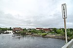
The Chops Passage is a channel in Sagadahoc County, Maine and is nearby to Chops Point, West Chops Point and Sturgeon Island. Merrymeeting Bay empties into the Kennebec River here before it heads to the Atlantic Ocean. Chop Point School and Chop Point Camp are also located on west Chops Point a Peninsula located at one side of The Chops. The Chops Passage is close to Goose Cove and Butler Cove, and marks the border between Bath, Maine, and Woolwich, Maine.
Excerpt from the Wikipedia article The Chops Passage (License: CC BY-SA 3.0, Authors).The Chops Passage
Chopps Point Road,
Geographical coordinates (GPS) Address Nearby Places Show on map
Geographical coordinates (GPS)
| Latitude | Longitude |
|---|---|
| N 43.981 ° | E -69.83 ° |
Address
Chopps Point Road
Maine, United States
Open on Google Maps


