Lagunitas Creek
Rivers of Marin County, CaliforniaRivers of Northern CaliforniaWest Marin

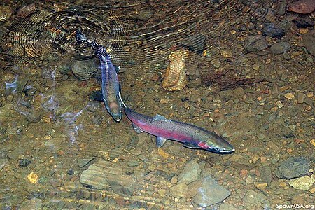
Lagunitas Creek is a 24 miles (39 km)-long northward-flowing stream in Marin County, California. It is critically important to the largest spawning runs of endangered coho salmon (Oncorhynchus kisutch) in the Central California Coast Coho salmon Evolutionary Significant Unit (CCC ESU).The stream's headwaters begin on the northern slopes of Mount Tamalpais in the Coast Range and terminate in southeast Tomales Bay, 1.5 miles (2.4 km) northwest of Point Reyes Station, California. Lagunitas Creek feeds several reservoirs on Mt. Tamalpais that supply a major portion of the county's drinking water.
Excerpt from the Wikipedia article Lagunitas Creek (License: CC BY-SA 3.0, Authors, Images).Lagunitas Creek
Tomales Bay,
Geographical coordinates (GPS) Address Nearby Places Show on map
Geographical coordinates (GPS)
| Latitude | Longitude |
|---|---|
| N 38.08 ° | E -122.82694444444 ° |
Address
Tomales Bay
Tomales Bay
94956
California, United States
Open on Google Maps


