place

Rancho Punta de los Reyes (Randall)

1836 establishments in Alta CaliforniaCalifornia ranchosGolden Gate National Recreation AreaRanchos of Marin County, CaliforniaWest Marin

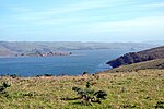
Rancho Punta de los Reyes was a 8,878-acre (35.93 km2) Mexican land grant in present-day western Marin County, California, given in 1836 by Governor Nicolás Gutiérrez to James Richard Berry and re-granted in 1838 by Governor Juan B. Alvarado to Joseph Snook. The grant extended along the west side of Tomales Bay and encompassed present day Inverness.

Excerpt from the Wikipedia article Rancho Punta de los Reyes (Randall) (License: CC BY-SA 3.0, Authors).

Rancho Punta de los Reyes (Randall)
Perth Fire Road,

Geographical coordinates (GPS) Address Nearby Places
placeShow on map

Wikipedia: Rancho Punta de los Reyes (Randall)Continue reading on Wikipedia

Geographical coordinates (GPS)

Latitude Longitude
N 38.09 ° E -122.87 °
placeShow on map

Address

Perth Fire Road

Perth Fire Road
94937
California, United States
mapOpen on Google Maps

Share experience

Nearby Places

Camp Hydle
Camp Hydle

Camp Hydle also called Drakes Bay Range was a large training center during World War II, located at Drakes Bay, on what is now Point Reyes National Seashore on the coast of northern California in the United States. The camp had several training sites: Camp Hydle, Drakes Bay Air to Ground Gunnery Range, Drakes Bay Dive Bombing Target, Camp Murphy's Ranch, Camp Hydle Maneuver Area, and Camp Hydle Skip and Dive Bombing Range. Also at the camp were landing craft training and air sea rescue training. The site was 10,532 acres of Marin County, California land on the West Coast of the United States. The complete area from Stinson Beach to the south and Dillon Beach to the north was called the Point Reyes Gunnery Range at Point Reyes. The Gunnery Range also included: two radar towers, horse stable, two lifeboat Stations, the Point Reyes Lighthouse, lookout towers, and land strafing targets (rake). The dive bomber airplanes came from Hamilton Army Airfield (AAF), Santa Rosa Army Airfield (AAF), and Naval Air Station Alameda (NAS). In addition to Drakes Bay the planes also training using the nearby Abbotts Lagoon, and Tomales Bay. The landing craft training used Limantour Beach and Limantour Spit. Anti-aircraft gun training was important training for the Pacific War. Camp Hydle base was inland 1/2 mile east of Limantour Beach. For gunner training planes towed targets across Drakes Bay. Ships also trained at the base, like the USS Walton and USS Nevada (BB-36). The Navy's Camp Hydle took over the Point Reyes Lifeboat Station during the war. The 50 men at the Station were air sea rescue pilots, dropping rafts to plane crew that landed in the ocean during training. The first troops arrived at the site on December 7, 1941. The site was also used as a coast defense spot, looking out for Japanese subs and ships. Most of the land was leased from Leland Murphy (Murphy Ranch), after the war in 1962, the site became Point Reyes National Seashore.

Tomales Bay
Tomales Bay

Tomales Bay is a long, narrow inlet of the Pacific Ocean in Marin County in northern California in the United States. It is approximately 15 mi (24 km) long and averages nearly 1.0 mi (1.6 km) wide, effectively separating the Point Reyes Peninsula from the mainland of Marin County. It is located approximately 30 mi (48 km) northwest of San Francisco. The bay forms the eastern boundary of Point Reyes National Seashore. Tomales Bay is recognized for protection by the California Bays and Estuaries Policy. On its northern end, it opens out onto Bodega Bay, which shelters it from the direct current of the Pacific (especially the California Current). The bay is formed along a submerged portion of the San Andreas Fault. Oyster farming is a major industry on the bay. The two largest producers are Hog Island Oyster Company and Tomales Bay Oyster Company, both of which retail oysters to the public and have picnic grounds on the east shore. Hillsides east of Tomales Bay are grazed by cows belonging to local dairies. There is also grazing land west of the bay, on farms and ranches leased from Point Reyes National Seashore. The bay sees significant amounts of water sports including sailing, kayaking, fishing and motor boating. Watercraft may be launched on Tomales Bay from the public boat ramp at Nick's Cove, north of Marshall. The sand bar at the mouth of Tomales Bay is notoriously dangerous, with a long history of small-boat accidents. The California Office of Environmental Health Hazard Assessment (OEHHA) has developed a safe eating advisory for fish caught here, based on levels of mercury or PCBs found in local species.Towns bordering Tomales Bay include Inverness, Inverness Park, Point Reyes Station, and Marshall. Additional hamlets include Nick's Cove, Spengers, Duck Cove, Shallow Beach, and Vilicichs. Dillon Beach lies just to the north of the mouth of the bay, and Tomales just to the east.