place

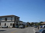
Inverness, California

Census-designated places in CaliforniaCensus-designated places in Marin County, CaliforniaPopulated coastal places in CaliforniaUse mdy dates from July 2023West Marin
Inverness, California March 2022 Sarah Stierch

Inverness is an unincorporated community and census-designated place (CDP) in western Marin County, California, United States. It is located on the southwest shore of Tomales Bay 3.5 miles (5.6 kilometers) northwest of Point Reyes Station and about 40 miles (65 km) by road northwest of San Francisco, at an elevation of 43 feet (13 meters). In the 2020 census, the population was 1,379. The community was named by a Scottish landowner after Inverness in Scotland.

Excerpt from the Wikipedia article Inverness, California (License: CC BY-SA 3.0, Authors, Images).

Inverness, California
Argyle Street,

Geographical coordinates (GPS) Address Nearby Places
placeShow on map

Wikipedia: Inverness, CaliforniaContinue reading on Wikipedia

Geographical coordinates (GPS)

Latitude Longitude
N 38.101111111111 ° E -122.85694444444 °
placeShow on map

Address

Argyle Street 4
94937
California, United States
mapOpen on Google Maps

Inverness, California March 2022 Sarah Stierch
Share experience

Nearby Places

Tomales Bay
Tomales Bay

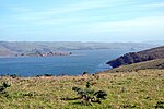
Tomales Bay is a long, narrow inlet of the Pacific Ocean in Marin County in northern California in the United States. It is approximately 15 mi (24 km) long and averages nearly 1.0 mi (1.6 km) wide, effectively separating the Point Reyes Peninsula from the mainland of Marin County. It is located approximately 30 mi (48 km) northwest of San Francisco. The bay forms the eastern boundary of Point Reyes National Seashore. Tomales Bay is recognized for protection by the California Bays and Estuaries Policy. On its northern end, it opens out onto Bodega Bay, which shelters it from the direct current of the Pacific (especially the California Current). The bay is formed along a submerged portion of the San Andreas Fault. Oyster farming is a major industry on the bay. The two largest producers are Hog Island Oyster Company and Tomales Bay Oyster Company, both of which retail oysters to the public and have picnic grounds on the east shore. Hillsides east of Tomales Bay are grazed by cows belonging to local dairies. There is also grazing land west of the bay, on farms and ranches leased from Point Reyes National Seashore. The bay sees significant amounts of water sports including sailing, kayaking, fishing and motor boating. Watercraft may be launched on Tomales Bay from the public boat ramp at Nick's Cove, north of Marshall. The sand bar at the mouth of Tomales Bay is notoriously dangerous, with a long history of small-boat accidents. The California Office of Environmental Health Hazard Assessment (OEHHA) has developed a safe eating advisory for fish caught here, based on levels of mercury or PCBs found in local species.Towns bordering Tomales Bay include Inverness, Inverness Park, Point Reyes Station, and Marshall. Additional hamlets include Nick's Cove, Spengers, Duck Cove, Shallow Beach, and Vilicichs. Dillon Beach lies just to the north of the mouth of the bay, and Tomales just to the east.