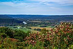
Mount Saviour Monastery
Mount Saviour Monastery is a historic farm and monastery campus within a national historic district located near Pine City, Chemung County, New York. It encompasses 10 contributing buildings and 3 contributing sites on a working farm in continuous operation since 1865. The monastery was founded in 1950 and the property is owned by the Benedictine Foundation of New York State. Located on the property are the contributing Our Lady Queen of Peace Chapel (1953) and East and West Buildings (1964), St. Joseph's House (1954-1957), St. Peter's House (Former Nagel/Hofbauer House, 1874), St. Gertrude's House (Former Durmstadt House, 1865), Mount Saviour Monastic Cemetery (1960), Good Shepherd Lay Cemetery (1955), St. Peter's Barn (Former Nagel/Hofbauer Barn, c.1890/1942), Main barn (1959), Arts & Crafts Building & Storage (Former Shop Building and Kiln, 1962/1973), Wagner House (Former Neilitz House, 1879), St. James's House (Former Harding House, 1870), and Annex (Former milk house and now monastery guest house, 1870/1961).It was added to the National Register of Historic Places in 2015.The Monastery of Christ in the Desert in Abiquiú, New Mexico developed from Mount Saviour in 1964.
Excerpt from the Wikipedia article Mount Saviour Monastery (License: CC BY-SA 3.0, Authors).Mount Saviour Monastery
Steege Hill Road, Town of Corning
Geographical coordinates (GPS) Address Nearby Places Show on map
Geographical coordinates (GPS)
| Latitude | Longitude |
|---|---|
| N 42.09 ° | E -76.959444444444 ° |
Address
Steege Hill Road 259
14830 Town of Corning
New York, United States
Open on Google Maps


