place

Griffith's Crossing railway station

Disused railway stations in GwyneddFormer London and North Western Railway stationsPages with no open date in Infobox stationRailway stations in Great Britain closed in 1937Railway stations in Great Britain opened in 1854
Use British English from June 2017
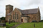
Approaching Griffith's Crossing geograph.org.uk 278327

Griffith's Crossing railway station was a former railway station located on the Bangor and Carnarvon Railway about a mile and a half south west of Port Dinorwic (now Y Felinheli), Gwynedd, Wales. It was opened in June 1854 with one platform and a single storey station building made of local stone with a booking office and waiting room. When the line was doubled in 1872, a second platform was constructed with a simple waiting shelter on it, made of similar materials to the main building. The two 320 ft platforms were connected by a level crossing. To the west was a small siding with a ramp. The station closed to passengers on 5 July 1937 when the platform and station buildings were demolished. Goods traffic continued to use it until 6 July 1964.On 13 November 1911 the royal train stopped at the station and its passengers embarked in order to travel to Caernarfon Castle so that the future Edward VIII could be Investitured. For the event additional temporary wooden buildings were erected and a canopy put up. The royal train stopped near the station again on 1 July 1969 for the investiture of Prince Charles. By this time, as the station was closed and demolished a temporary platform and buildings were erected. The site of the station was partly covered following the improvement and widening of the A487. However the station master's house still stands.

Excerpt from the Wikipedia article Griffith's Crossing railway station (License: CC BY-SA 3.0, Authors, Images).

Griffith's Crossing railway station
Caernarfon Road,

Geographical coordinates (GPS) Address Nearby Places
placeShow on map

Wikipedia: Griffith's Crossing railway stationContinue reading on Wikipedia

Geographical coordinates (GPS)

Latitude Longitude
N 53.167797 ° E -4.238651 °
placeShow on map

Address

Ffordd Caernarfon

Caernarfon Road
LL55 1TS , Y Felinheli
Wales, United Kingdom
mapOpen on Google Maps

Approaching Griffith's Crossing geograph.org.uk 278327
Share experience

Nearby Places

Menai Strait
Menai Strait

The Menai Strait (Welsh: Afon Menai, the "river Menai") is a narrow stretch of shallow tidal water about 25 km (16 mi) long, which separates the island of Anglesey from the mainland of Wales. It varies in width from 400 metres (1,300 ft) from Fort Belan to Abermenai Point to 1,100 metres (3,600 ft) from Traeth Gwyllt to Caernarfon Castle. It then narrows to 500 metres (1,600 ft) in the middle reaches (Y Felinheli and Menai Bridge) and then it broadens again. At Bangor, Garth Pier, it is 900 metres (3,000 ft) wide. It then widens out, and the distance from Puffin Island (Welsh: Ynys Seiriol) to Penmaenmawr is about 8 kilometres (5.0 mi).The differential tides at the two ends of the strait cause very strong currents to flow in both directions through the strait at different times, creating dangerous conditions. One of the most dangerous areas of the strait is known as the Swellies (or Swillies – Welsh Pwll Ceris) between the two bridges. Here, rocks near the surface cause over-falls and local whirlpools, which can be of considerable danger in themselves and cause small boats to founder on the rocks. This was the site of the loss of the training ship HMS Conway in 1953. Entering the strait at the Caernarfon end is also hazardous because of the frequently shifting sand banks that make up Caernarfon bar. On the mainland side at this point is Fort Belan, an 18th-century defensive fort built in the times of the American War of Independence (1775–1783). The strait is bridged in two places: the Menai Suspension Bridge (Welsh: Pont Grog y Borth) carrying the A5, and Robert Stephenson's 1850 Britannia Tubular Bridge (Welsh: Pont Britannia or Pont Llanfair). Originally the Britannia carried rail traffic in two wrought-iron rectangular box spans but after a disastrous fire in 1970, which left only the limestone pillars remaining, it was rebuilt as a steel box girder bridge, and now carries both rail and road traffic (A55). Between the two bridge crossings there is a small island in the middle of the strait, Ynys Gorad Goch, on which are built a house and outbuildings and around which are the significant remains of fish traps, no longer used.

Old Church of St Nidan, Llanidan

The Old Church of St Nidan, Llanidan is a medieval church in the community of Llanidan, in Anglesey, North Wales, close to the Menai Strait. The first church on the site was established in the 7th century by St Nidan, the confessor of the monastery at Penmon, Anglesey, but the oldest parts of the present structure, are now closed and partly ruined, date from the 14th century. In about 1500 the church was enlarged by the addition of a second nave on the north side, separated from the earlier nave by an arcade of six arches. During 1839 till 1843 a new church was built nearby to serve the local community, partly due to the cost of repairing the old church. Much of the building was subsequently demolished, leaving only part of the western end and the central arcade. The decision was condemned at the time by Harry Longueville Jones, a clergyman and antiquarian, who lamented the "melancholy fate" of what he called "one of the largest and most important [churches] in the island of Anglesey". Other appreciative comments have been made about the church both before and after its partial demolition. After that a new church was opened, the old church was used as a chapel for funerals for a period of time. It has been restored by the owners of the adjoining house, Plas Llanidan, and is occasionally open to the public. The remaining parts of the church are a Grade II* listed building, a national designation given to "particularly important buildings of more than special interest", in particular because St Nidan's is regarded as "a good example of a simple medieval rural church, enriched by 15th-century additions".In the 12th century, Gerald of Wales said that the church possessed a curious stone carving similar to a thigh that would always return by the next day no matter how far away it was taken. A Norman earl, he recounted, had chained it to a large rock and thrown it into the sea, only for the stone to return to the church by the following morning. A sandstone chest containing bone fragments, possibly are relics of a saint, were found buried beneath the altar. The chest and the church's 13th-century font were relocated to the new church.