place

Poor Mountain

Blue Ridge MountainsLandforms of Montgomery County, VirginiaLandforms of Roanoke County, VirginiaRidges of Virginia
Poor Mountain
Poor Mountain

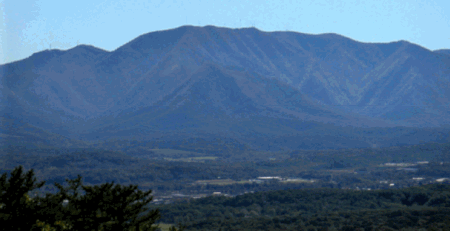
Poor Mountain is a ridge of high peaks located in Roanoke County, Virginia and Montgomery County, Virginia. At 3,928 feet, Poor Mountain is the tallest mountain in the immediate area. Poor Mountain has the largest known population, by far, of piratebush (Buckleya distichophylla), a plant which draws nutrients from the roots of Eastern Hemlock trees. Piratebush is found only in limited numbers at a few other locations in Virginia, North Carolina, and Tennessee. The Poor Mountain Natural Area Preserve has been established to protect this population. Twelve O'clock Knob is located adjacent to Poor Mountain in Roanoke County directly south of Salem, Virginia. The north slope of the ridgeline formed by Poor Mountain and Twelve O'clock Knob marks the southwestern boundary of the Roanoke Valley. Fort Lewis Mountain is located directly across the valley from Poor Mountain.

Excerpt from the Wikipedia article Poor Mountain (License: CC BY-SA 3.0, Authors, Images).

Poor Mountain
Honeysuckle Road,

Geographical coordinates (GPS) Address Nearby Places
placeShow on map

Wikipedia: Poor MountainContinue reading on Wikipedia

Geographical coordinates (GPS)

Latitude Longitude
N 37.17956 ° E -80.162753 °
placeShow on map

Address

Honeysuckle Road 7995
24059
Virginia, United States
mapOpen on Google Maps

Poor Mountain
Poor Mountain
Share experience

Nearby Places

Elliston-Lafayette, Virginia

Elliston-Lafayette was a census-designated place (CDP) in Montgomery County, Virginia, United States. The population was 1,241 at the 2000 census; in 2010, Elliston and Lafayette were split into separate CDPs. It is part of the Blacksburg–Christiansburg Metropolitan Statistical Area, which encompasses all of Montgomery County, Virginia, including the towns of Blacksburg and Christiansburg, and the city of Radford. However, many residents of the eastern section of Montgomery County more often travel to Roanoke or Salem for work, shopping, and services since these cities are generally closer and do not require driving up Christiansburg Mountain on U.S. Route 460 (which is a concurrency with U.S. Route 11 here) or Interstate 81. Elliston and Lafayette are also considered distinct communities by most local residents. Lafayette is located along the Roanoke River just across the Roanoke County line. The north fork and south fork of the river join near Interstate 81 north of Lafayette. While Lafayette is named for the Marquis de Lafayette, it is pronounced "Luh-fett" or "Luh-fay-ett". The center of Elliston, which is the larger community, is approximately three miles west of Lafayette on US 460. Shawsville is approximately four miles west of Elliston. The majority of US 460 between the communities is a completely straight stretch of road, which is not common in this area of Virginia, known locally as the Elliston Straightaway. During the 1990s, there was some minor controversy between Elliston and Shawsville about how far down the Elliston Straightaway would be the appropriate place for a "Welcome to Shawsville" sign. Additionally, Shawsville Elementary School also resides in 24087, the Elliston ZIP Code.