place

Sarn Helen

Archaeological sites in CarmarthenshireArchaeological sites in CeredigionArchaeological sites in Conwy County BoroughArchaeological sites in GwyneddArchaeological sites in Neath Port Talbot
Archaeological sites in PowysArchaeological sites in SnowdoniaBetws-y-CoedBrecon Beacons National ParkBrithdir and LlanfachrethBro MachnoCaerhunCapel CurigCorrisDolgarrogDolgellauDolwyddelanElenyddFfestiniogFootpaths in CarmarthenshireFootpaths in CeredigionFootpaths in Conwy County BoroughFootpaths in GwyneddFootpaths in Neath Port TalbotFootpaths in PowysFootpaths in SnowdoniaGanllwydLlanelltydLong-distance footpaths in WalesMaentwrogPennalRoads in CarmarthenshireRoads in CeredigionRoads in Conwy County BoroughRoads in GwyneddRoads in Neath Port TalbotRoads in PowysRoads in SnowdoniaRoman roads in WalesTrawsfynyddTrefriwUse British English from February 2013
Sarn Helen south of Stags Head, Ceredigion geograph.org.uk 2522632

Sarn Helen refers to several stretches of Roman road in Wales. The 160-mile (260 km) route, which follows a meandering course through central Wales, connects Aberconwy in the north with Carmarthen in the west. Despite its length, academic debate continues as to the precise course of the Roman road. Many sections are now used by the modern road network while other parts are still traceable. However, there are sizeable stretches that have been lost and are unidentifiable. The route is named after Saint Elen of Caernarfon, a Celtic saint, whose story is told in The Dream of Macsen Wledig, part of the Mabinogion. She is said to have ordered the construction of roads in Wales during the late 4th century.

Excerpt from the Wikipedia article Sarn Helen (License: CC BY-SA 3.0, Authors, Images).

Sarn Helen
Lower Gate Street,

Geographical coordinates (GPS) Address Nearby Places
placeShow on map

Wikipedia: Sarn HelenContinue reading on Wikipedia

Geographical coordinates (GPS)

Latitude Longitude
N 53.282 ° E -3.828 °
placeShow on map

Address

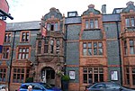
Liverpool Arms

Lower Gate Street
LL32 8BE
Wales, United Kingdom
mapOpen on Google Maps

Sarn Helen south of Stags Head, Ceredigion geograph.org.uk 2522632
Share experience

Nearby Places

Plas Mawr
Plas Mawr

Plas Mawr (English: Great Hall) is an Elizabethan townhouse in Conwy, North Wales, dating from the 16th century. The property was built by Robert Wynn, a member of the local gentry, following his marriage to his first wife, Dorothy Griffith. Plas Mawr occupied a plot of land off Conwy's High Street and was constructed in three phases between 1576 and 1585 at a total cost of around £800. Wynn was known for his hospitality, and the household was supported by Wynn's local dairy herds, orchards and gardens. On his death he laid out complex instructions for dividing his estate; the resulting law-case took years to resolve, effectively preventing the redevelopment of the house and preserving it in its original condition. After 1683 Plas Mawr passed into the hands of the Mostyn family and ceased to be used as a family home. It was rented out for various purposes during the 18th and 19th centuries, including for use as a school, cheap lodgings and finally as the headquarters of the Royal Cambrian Academy of Art. In the 20th century the house became increasingly well known for its preserved Elizabethan architecture, but the costs of maintenance grew considerably and its condition deteriorated. The Welsh heritage agency Cadw took over the management of the property in 1993 and carried out an extensive, 42-month-long restoration project at a total cost of £3.3 million. With many of its rooms redecorated to resemble their condition in 1665, and replanted Renaissance gardens, it is now run as a tourist attraction. Architecturally, Plas Mawr is almost unchanged from the 16th century, and the historian Rick Turner considers the house to be "the finest surviving town house of the Elizabethan era". Plas Mawr shows a blend of continental Renaissance and local North Wales influences, with an innovative floor-plan and architectural detailing. The house still retains much of its original plasterwork, which incorporates symbols, badges and heraldry, which the historian Peter Smith has described as "the most perfect and the most complete memorial to Elizabethan Wales." The architecture of the house influenced other contemporary projects in North Wales, and was later copied during the 19th and 20th centuries in buildings around the town of Conwy, including the local police station and nearby hotel.

St Mary and All Saints' Church, Conwy

The Church of St Mary & All Saints is the parish church of Conwy, Wales in the United Kingdom. It was originally the Cistercian Aberconwy Abbey, but in 1283 King Edward I of England moved the Abbey to Maenan. The parish registers date back to 1541. The foundations of the church date back to 1172, and the Aberconwy Abbey was completed in 1186. Since then the church has grown and changed. The East and West-end buttresses and parts of the walls, particularly on the North side, are original. In the fourteenth century, the church received the lower portion of its tower, the South transept, and the North and South porches. A room north of the tower was enclosed to serve as a charnel house. The fifteenth century saw the completion of the tower, and the installation of the rood screen and the early Tudor period baptismal font. This includes Sir Richard Pole's, badge, (an eagle's claw grabbing a fish) who was the constable of Conwy castle between 1488 and 1504.In the sixteenth century the roofs over the aisles were raised. Next to the altar at the south end is the tomb of Robert Wynne, a major benefactor of St Mary's, and the builder of Plas Mawr on Conwy's High Street. The chancel floor was raised at a later date, and in 1872 the roof of the nave was raised by Gilbert Scott. At some point the South window of the transept was reconstructed and the clerestory windows were reset to where they now remain. Also in the nineteenth century, Lord Penrhyn donated the tower clock. In 1921 the church received a memorial chapel on the church's north side, and five years later the vestry was enlarged. In 1949 the former charnel house became the Parish Room. The church holds a number of objects of interest dating back to medieval times, and two windows in the nave's south aisle made by Morris & Co., a workshop with associations with the Pre-Raphaelite artist Edward Burne-Jones.In the summer months the church is a venue for Conwy's Classical Music Festival, a series of weekly hour-long concerts by professional musicians.

Aberconwy Abbey
Aberconwy Abbey

Aberconwy Abbey was a Cistercian foundation at Conwy, later transferred to Maenan near Llanrwst, and in the 13th century was the most important abbey in the north of Wales. A Cistercian house was founded at Rhedynog Felen near Caernarfon in 1186 by a group of monks from Strata Florida Abbey. About four or five years later they moved to Conwy, and in 1199 were given large grants of land by Llywelyn the Great who had recently become ruler of Gwynedd. Llywelyn was regarded as the founder of the house, and thanks to his support it came to hold more land than any other Welsh abbey, over 40,000 acres (160 km²). On Llywelyn's death in 1240 he was buried at the abbey, and his son and successor Dafydd ap Llywelyn was also buried here in 1246. In 1248 Llywelyn's other son, Gruffydd ap Llywelyn, who had died trying to escape from the Tower of London in 1244, was reburied at Aberconwy after the abbot of Aberconwy, together with the abbot of Strata Florida, had arranged for his body to be repatriated from London. The abbot of Aberconwy was an important figure in the negotiations between Llywelyn ap Gruffudd and the English crown later in the century, and in 1262 was entrusted with the task of being Llywelyn's sole representative in negotiations. In 1282, Edward I of England surrounded Snowdonia with a massive army. On 11 December Llywelyn ap Gruffudd, Tywysog Cymru, was lured into a trap and murdered. In 1283 King Edward I of England obliged the monks to move from Conwy to Maenan, further up the Conwy valley (53.1733°N 3.8123°W / 53.1733; -3.8123 (Maenan Abbey)), so he could construct a castle and walled town at Conwy. The move had been completed by 1284, with Edward financing the building of a new abbey. In the 15th century the abbot, John ap Rhys, became involved in a dispute with Strata Florida Abbey and led some of his monks and some soldiers on a raid on that abbey. The abbey was valued at £162 in 1535 and was suppressed in 1537. Little remains of the Maenan Abbey buildings, but the original abbey church in Conwy was adapted to become the parish church of St Mary & All Saints and although much rebuilt over the centuries some parts of the original church remain. The other buildings of the abbey are thought to have been located north and east of the church, including where Conwy Castle now stands.

Conwy Castle
Conwy Castle

Conwy Castle (Welsh: Castell Conwy; Welsh pronunciation: [kastɛɬ 'kɔnwɨ̞]) is a fortification in Conwy, located in North Wales. It was built by Edward I, during his conquest of Wales, between 1283 and 1287. Constructed as part of a wider project to create the walled town of Conwy, the combined defences cost around £15,000, a massive sum for the period. Over the next few centuries, the castle played an important part in several wars. It withstood the siege of Madog ap Llywelyn in the winter of 1294–95, acted as a temporary haven for Richard II in 1399 and was held for several months by forces loyal to Owain Glyndŵr in 1401. Following the outbreak of the English Civil War in 1642, the castle was held by forces loyal to Charles I, holding out until 1646 when it surrendered to the Parliamentary armies. In the aftermath, the castle was partially slighted by Parliament to prevent it being used in any further revolt, and was finally completely ruined in 1665 when its remaining iron and lead was stripped and sold off. Conwy Castle became an attractive destination for painters in the late 18th and early 19th centuries. Visitor numbers grew and initial restoration work was carried out in the second half of the 19th century. In the 21st century, the ruined castle is managed by Cadw as a tourist attraction. UNESCO considers Conwy to be one of "the finest examples of late 13th century and early 14th century military architecture in Europe", and it is classed as a World Heritage Site. The rectangular castle is built from local and imported stone and occupies a coastal ridge, originally overlooking an important crossing point over the River Conwy. Divided into an Inner and an Outer Ward, it is defended by eight large towers and two barbicans, with a postern gate leading down to the river, allowing the castle to be resupplied from the sea. It retains the earliest surviving stone machicolations in Britain and what historian Jeremy Ashbee has described as the "best preserved suite of medieval private royal chambers in England and Wales". In keeping with other Edwardian castles in North Wales, the architecture of Conwy has close links to that found in the Savoy during the same period, an influence probably derived from the Savoy origins of the main architect, James of Saint George.