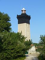
Vidourle
Coastal basins of the Mediterranean Sea in FranceFrance river stubsOccitania (administrative region) geography stubsPages with French IPARivers of France ... and 3 more
Rivers of GardRivers of HéraultRivers of Occitania (administrative region)

The Vidourle (French pronunciation: [viduʁl]; Vidorle in occitan) is a 95.0 km (59.0 mi) river in southern France that flows into the Mediterranean Sea in Le Grau-du-Roi. Its source is in the Cévennes mountains, northwest of Saint-Hippolyte-du-Fort, at Saint-Roman-de-Codières. It flows generally southeast. At Gallargues-le-Montueux, it was crossed by the old Roman road Via Domitia with the now ruined Roman bridge Pont Ambroix. The Vidourle flows through the following departments and towns: Gard: Saint-Roman-de-Codières, Saint-Hippolyte-du-Fort, Sauve, Quissac, Sommières Hérault: Lunel, Marsillargues Gard: Saint-Laurent-d'Aigouze, Le Grau-du-Roi
Excerpt from the Wikipedia article Vidourle (License: CC BY-SA 3.0, Authors, Images).Vidourle
Promenade du Front de Mer, Nîmes
Geographical coordinates (GPS) Address Nearby Places Show on map
Geographical coordinates (GPS)
| Latitude | Longitude |
|---|---|
| N 43.535555555556 ° | E 4.1341666666667 ° |
Address
Promenade du Front de Mer
Promenade du Front de Mer
30240 Nîmes
Occitania, France
Open on Google Maps


