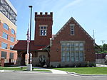
Sycamore Creek (Michigan)

Sycamore Creek is a tributary of the Red Cedar River in the state of Michigan in the United States. The stream is 26.5 miles (42.6 km) long and drains an area of 106.1 square miles (275 km2) on the central Lower Peninsula, in and around the city of Lansing. Via the Red Cedar River, it is part of the watershed of the Grand River, which flows to Lake Michigan. Via Lake Michigan and the Great Lakes system, it is part of the larger watershed of the St. Lawrence River. Sycamore Creek flows for its entire length in Ingham County. It begins in Leslie Township, approximately 2.4 miles (3.9 km) northwest of the city of Leslie, and flows generally north-northwestward through Leslie and Vevay townships; the city of Mason; Alaiedon and Delhi townships; and the southeastern part of the city of Lansing. It flows into the Red Cedar River in Lansing, 1.6 miles (2.6 km) upstream of the Red Cedar River's mouth at the Grand River.
Excerpt from the Wikipedia article Sycamore Creek (Michigan) (License: CC BY-SA 3.0, Authors, Images).Sycamore Creek (Michigan)
Lansing River Trail, Lansing
Geographical coordinates (GPS) Address Nearby Places Show on map
Geographical coordinates (GPS)
| Latitude | Longitude |
|---|---|
| N 42.7142018 ° | E -84.5283112 ° |
Address
Lansing River Trail
Lansing River Trail
48910 Lansing
Michigan, United States
Open on Google Maps


