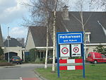
Doornsteeg
Gelderland geography stubsNijkerkPopulated places in Gelderland

Doornsteeg is a neighbourhood of Nijkerk and a hamlet in the Dutch province of Gelderland. It is a part of the municipality of Nijkerk, and lies about 8 km northeast of Amersfoort.It was first mentioned in 1556 as Dorenstege, and means "thorny path". The hamlet consists of about 25 houses. Since 2016, Nijkerk has started to build a new neighbourhood near the hamlet. It will consists of about 1,200 houses and cover an area of 59 hectares (150 acres).
Excerpt from the Wikipedia article Doornsteeg (License: CC BY-SA 3.0, Authors, Images).Doornsteeg
Olevoortseweg, Nijkerk
Geographical coordinates (GPS) Address Nearby Places Show on map
Geographical coordinates (GPS)
| Latitude | Longitude |
|---|---|
| N 52.23027 ° | E 5.4517 ° |
Address
Olevoortseweg
Olevoortseweg
3861 MH Nijkerk
Gelderland, Netherlands
Open on Google Maps


