place

National Baptist Memorial Church

1906 establishments in Washington, D.C.Baptist churches in Washington, D.C.Buildings and structures in Washington, D.C.Christian organizations established in 1906Churches in Washington, D.C.
National Baptist Memorial Church DC 02 (cropped)

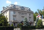
National Baptist Memorial Church is a Baptist church in Washington, D.C. It is located at the intersection of 16th Street NW and Columbia Road, where the Mt. Pleasant, Columbia Heights and Adams Morgan neighborhoods meet. The crossroads is notable for the triple steeples of National Baptist Memorial Church, All Souls Unitarian Church and the Unification Church's cathedral (formerly the Mormon's Washington Chapel). It is affiliated with the American Baptist Churches USA, the Progressive National Baptist Convention, and to a certain extent the Southern Baptist Convention. Rev. Kasey D. Jones became the senior pastor in 2006 and served until 2017. She was the first woman and the first African-American to serve in that role. Rev. Dr. Charles E. Collins, Jr. has served as the interim pastor since 2017.

Excerpt from the Wikipedia article National Baptist Memorial Church (License: CC BY-SA 3.0, Authors, Images).

National Baptist Memorial Church
Columbia Road Northwest, Washington Columbia Heights

Geographical coordinates (GPS) Address Nearby Places
placeShow on map

Wikipedia: National Baptist Memorial ChurchContinue reading on Wikipedia

Geographical coordinates (GPS)

Latitude Longitude
N 38.926952833333 ° E -77.036027 °
placeShow on map

Address

Columbia Road Northwest 1501
20009 Washington, Columbia Heights
District of Columbia, United States
mapOpen on Google Maps

National Baptist Memorial Church DC 02 (cropped)
Share experience

Nearby Places

Mount Pleasant (Washington, D.C.)

Mount Pleasant is a neighborhood in the northwestern quadrant of Washington, D.C. It is bounded by Rock Creek Park to the north and west; Harvard Street NW to the south; and 16th Street NW to the east. It is north of Adams Morgan and west of Columbia Heights. It is home to approximately 10,000 people. The western four-fifths of the neighborhood is a largely wooded residential enclave bounded on two sides by Rock Creek Park, just east of the National Zoo. Structures in this area are primarily row houses of Neoclassical architecture with rear porches, with some subdivided into multiple apartments. The Eighteen Hundred Block Park Road, NW is notable for its ten detached "suburban" houses on terraces overlooking the street. The twelve buildings at 1644–1666 Park Road NW, designed by Appleton P. Clark Jr. in the style of Colonial Revival architecture, were completed in 1906.The eastern side of the neighborhood, along 16th Street NW and Mount Pleasant Street, is marked by mid-rise apartment buildings. These buildings offer rental apartments, condominiums and housing cooperatives. A four-block commercial corridor with convenience shopping extends along Mount Pleasant Street. It is also walking distance from larger retail developments in Columbia Heights. The neighborhood is served by the Mount Pleasant Line and the Crosstown Line buses. A series of "Heritage Trail" historical markers are installed in Mount Pleasant. The markers, which may be followed as a walking tour, consist of 17 poster-sized street signs featuring narrative, photographs and maps.