place

Whakatu, Hawke's Bay

Hastings DistrictPopulated places in the Hawke's Bay RegionUse New Zealand English from January 2021

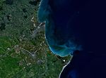
Whakatu is a rural community in the Hastings District and Hawke's Bay Region of New Zealand's North Island. It is located 8 kilometres (5.0 mi) north-east of the centre of Hastings. A large industrial area is enclosed by a bend in the Clive River, and the closure of the freezing works in Whakatu in 1986 cost the region 2000 full-time and seasonal jobs. State Highway 2 and the Palmerston North–Gisborne Line pass through Whakatu. Richard Tucker (1856–1922) was a notable resident of Whakatu; he owned the largest wool-scouring plant in the Hawke's Bay Region.

Excerpt from the Wikipedia article Whakatu, Hawke's Bay (License: CC BY-SA 3.0, Authors).

Whakatu, Hawke's Bay
Station Road,

Geographical coordinates (GPS) Address Nearby Places
placeShow on map

Wikipedia: Whakatu, Hawke's BayContinue reading on Wikipedia

Geographical coordinates (GPS)

Latitude Longitude
N -39.606 ° E 176.892 °
placeShow on map

Address

Station Road 16
4102
Hawke's Bay, New Zealand
mapOpen on Google Maps

Share experience

Nearby Places

Napier-Hastings Urban Area

The Napier-Hastings Urban Area was defined by Statistics New Zealand (Stats NZ) as a main urban area of New Zealand that was based around the twin cities of Napier and Hastings in the Hawke's Bay Region. It was defined under the New Zealand Standard Areas Classification 1992 (NZSAC92), which has since been superseded by the Statistical Standard for Geographic Areas 2018 (SSGA18). The urban area lay mostly on the Heretaunga Plains, with part on surrounding hills. It was a city cluster consisting of the cities of Napier and Hastings, the town of Havelock North and some smaller settlements. It was the sixth-most-populous urban area in the country under the NZSAC92, with 134,500 residents, fewer than Tauranga (141,600) and more than Dunedin (122,000). While the two cities are separated by 9 km (5.6 mi) of rural land from city edge to edge (20 km from one city centre to the next), there is sufficient economic and social integration between the cities that Stats NZ treated them as a single urban area. Stats NZ also subdivided the urban area into urban zones, as they did for the urban areas of Auckland, Hamilton and Wellington. The Napier-Hastings Urban Area contains about three-quarters of the population of the entire Hawke's Bay. Under SSGA18, Stats NZ split up the Napier-Hastings Urban Area for statistical purposes. It was split into two "large urban areas" (30,000 to 99,999 population) of Napier and Hastings, the "medium urban area" (10,000 to 29,999) of Havelock North, the "small urban area" (1,000 to 9,999) of Clive, and the "rural settlements" (300 to 999) of Haumoana, Te Awanga, Whakatu and Whirinaki. Some settlements of less than 300 that were included in the Napier-Hastings Urban Area were left out entirely, including Eskdale, Omahu, Pakipaki, Pakowhai and Waiohiki. Stats NZ similarly split Wellington into Lower Hutt, Porirua, Upper Hutt and the urban part of Wellington City under SSGA18.