Lake Harrison
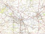
Lake Harrison or Lake Bosworth is the name given to a lake that in parts of the Ice Age may have covered much of the Midlands in England around Warwick, Birmingham and Leicester. It is suggested that it was formed when ice sheets over Wales and Northern England blocked drainage north-eastwards, trapping a lake between this and the Cotswolds. Finally the lake made two overflow courses, until drainage by the Cole and Soar could resume due to glacial retreat: South-east. Across the Fenny Compton Gap into the Cherwell which drains into the Thames. This has become a wind gap. South-west. This course became lasting for the south-west zone of where the lake was, as the River Avon, Warwickshire which flows into the Severn. See also stream capture. The extent of this proposed lake has been disputed, and it is now thought that several smaller proglacial lakes may explain the glacial deposits in the area.
Excerpt from the Wikipedia article Lake Harrison (License: CC BY-SA 3.0, Authors).Lake Harrison
Harefield Lane, Nuneaton and Bedworth Bermuda
Geographical coordinates (GPS) Address Nearby Places Show on map
Geographical coordinates (GPS)
| Latitude | Longitude |
|---|---|
| N 52.5 ° | E -1.5 ° |
Address
Harefield Lane
Harefield Lane
CV10 7PR Nuneaton and Bedworth, Bermuda
England, United Kingdom
Open on Google Maps


