River Brue

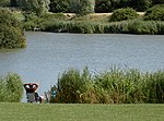
The River Brue originates in the parish of Brewham in Somerset, England, and reaches the sea some 50 kilometres (31 mi) west at Burnham-on-Sea. It originally took a different route from Glastonbury to the sea, but this was changed by Glastonbury Abbey in the twelfth century. The river provides an important drainage route for water from a low-lying area which is prone to flooding which man has tried to manage through rhynes, canals, artificial rivers and sluices for centuries. The Brue Valley Living Landscape is an ecological conservation project based on the Somerset Levels and Moors and managed by the Somerset Wildlife Trust. The valley includes several Sites of Special Scientific Interest including Westhay Moor, Shapwick Heath and Shapwick Moor. Much of the area has been at the centre of peat extraction on the Somerset Levels. The Brue Valley Living Landscape project commenced in January 2009 to restore and reconnect habitat that will support wildlife. The aim is to be able to sustain itself in the face of climate change while guaranteeing farmers and other landowners can continue to use their land profitably. It is one of an increasing number of landscape scale conservation projects in the UK.
Excerpt from the Wikipedia article River Brue (License: CC BY-SA 3.0, Authors, Images).River Brue
South Esplanade,
Geographical coordinates (GPS) Address Nearby Places Show on map
Geographical coordinates (GPS)
| Latitude | Longitude |
|---|---|
| N 51.225555555556 ° | E -3.0036111111111 ° |
Address
South Esplanade
TA8 1BU , Burnham-on-Sea and Highbridge
England, United Kingdom
Open on Google Maps


