Burnham-on-Sea

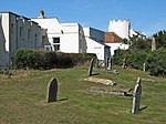
Burnham-on-Sea is a seaside town in Somerset, England, at the mouth of the River Parrett, upon Bridgwater Bay. Burnham was a small fishing village until the late 18th century when it began to grow because of its popularity as a seaside resort. Burnham-on-Sea forms part of the parish of Burnham-on-Sea and Highbridge and shares a town council with its neighbouring small market town of Highbridge. According to the 2011 census the population of the parish (including Highbridge) was 19,576, of which the most populous wards 'Burnham Central' and 'Burnham North'; totalled 13,601. Burnham-on-Sea is famous for its low lighthouse. The lighthouse was built in 1832 and is a Grade-II listed building with a red and white striped facade. The position of the town on the edge of the Somerset Levels and moors where they meet the Bristol Channel, has resulted in a history dominated by land reclamation and sea defences since Roman times. Burnham was seriously affected by the Bristol Channel floods of 1607, with the present curved concrete wall being completed in 1988. There have been many shipwrecks on the Gore Sands, which lie just offshore and can be exposed at low tides. Lighthouses are hence prominent landmarks in the town, with the original lighthouse known as the Round Tower built to replace the light on the top of the 14th-century tower of St Andrews Church. The 110-foot (34-metre) pillar or High Lighthouse and the low wooden pile lighthouse or Lighthouse on legs on the beach were built to replace it. The town's first lifeboat was provided in 1836 by the Corporation of Bridgwater.
Excerpt from the Wikipedia article Burnham-on-Sea (License: CC BY-SA 3.0, Authors, Images).Burnham-on-Sea
Schmiedeackerstraße,
Geographical coordinates (GPS) Address Nearby Places Show on map
Geographical coordinates (GPS)
| Latitude | Longitude |
|---|---|
| N 51.237777777778 ° | E -2.9988888888889 ° |
Address
Schmiedeackerstraße 16
27442
Niedersachsen, Deutschland
Open on Google Maps


