place

The King Alfred School, Highbridge

Academies in SomersetSecondary schools in SomersetSomerset building and structure stubsSouth West England school stubsUse British English from February 2023
King Alfred's School, Highbridge

The King Alfred School is a coeducational secondary school and sixth form located in Highbridge, Somerset, England. It is an academy and part of The Priory Learning Trust. It serves Brent Knoll, Highbridge, Burnham-on-Sea and the surrounding villages. In 2007, the school celebrated its 50th anniversary. In 2017 it had 1375 pupils.The school is associated with the King Alfred Sports Centre which is next to the school site. There is some evidence of Roman remains under the school playing field.

Excerpt from the Wikipedia article The King Alfred School, Highbridge (License: CC BY-SA 3.0, Authors, Images).

The King Alfred School, Highbridge
Burnham Road,

Geographical coordinates (GPS) Address Phone number Website External links Nearby Places
placeShow on map

Wikipedia: The King Alfred School, HighbridgeContinue reading on Wikipedia

Geographical coordinates (GPS)

Latitude Longitude
N 51.228 ° E -2.984 °
placeShow on map

Address

The King Alfred School

Burnham Road
TA9 3EE , Burnham-on-Sea and Highbridge
England, United Kingdom
mapOpen on Google Maps

Phone number

call+441278784881

Website
tkasa.org.uk

linkVisit website

linkWikiData (Q7744496)
linkOpenStreetMap (9452722)

King Alfred's School, Highbridge
Share experience

Nearby Places

River Parrett
River Parrett

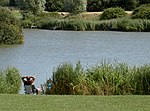
The River Parrett flows through the counties of Dorset and Somerset in South West England, from its source in the Thorney Mills springs in the hills around Chedington in Dorset. Flowing northwest through Somerset and the Somerset Levels to its mouth at Burnham-on-Sea, into the Bridgwater Bay nature reserve on the Bristol Channel, the Parrett and its tributaries drain an area of 660 square miles (1,700 km2) – about 50 per cent of Somerset's land area, with a population of 300,000.The Parrett's main tributaries include the Rivers Tone, Isle, and Yeo, and the River Cary via the King's Sedgemoor Drain. The 37-mile (60 km) long river is tidal for 19 miles (31 km) up to Oath. The fall of the river between Langport and Bridgwater is only 1 foot per mile (0.2 m/km), so it is prone to frequent flooding in winter and during high tides. Many approaches have been tried since at least the medieval period to reduce the incidence and effect of floods and to drain the surrounding fields. In Anglo-Saxon times the river formed a boundary between Wessex and Dumnonia. It later served the Port of Bridgwater, and enabled cargoes to be transported inland. The arrival of the railways led to a decline in commercial shipping, and the only working docks are at Dunball. Human influence on the river has left a legacy of bridges and industrial artefacts. The Parrett along with its connected waterways and network of drains supports an ecosystem that includes several rare species of flora and fauna. The River Parrett Trail has been established along the banks of the river.