place

Prall's Island

Bird sanctuaries of the United StatesIslands of New York CityIslands of Staten IslandNature reserves in New York (state)Protected areas of Staten Island
Staten Island geography stubsUninhabited islands of New York (state)
Wpdms nygis pralls island

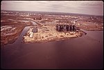
Prall's Island is an uninhabited island in the Arthur Kill between Staten Island, New York, and Linden, New Jersey, in the United States. The 89-acre (0.36 km2) island is one of the minor islands that are part of the borough of Staten Island in New York City. The island is named for a descendant or descendants of early Staten Island settler Arendt Jansen Prall Van Naarden (c. 1647–1725) (in Dutch, Praal), probably his grandson Abraham Prall (1706–1775), a local farmer. It was originally known as Dongan's Island, after New York Governor Thomas Dongan (1634–1715), who took the office in 1688. The name was later corrupted to Duncan's Island. Prall's Island did not take hold until the late 19th century. Around 1910, the water between Staten Island and the island was known as Prall's River but was eventually returned to Arthur Kill. The island is now owned by the City of New York and is maintained by New York City Department of Parks and Recreation as a bird sanctuary.

Excerpt from the Wikipedia article Prall's Island (License: CC BY-SA 3.0, Authors, Images).

Prall's Island
Meredith Avenue, New York Staten Island

Geographical coordinates (GPS) Address External links Nearby Places
placeShow on map

Wikipedia: Prall's IslandContinue reading on Wikipedia

Geographical coordinates (GPS)

Latitude Longitude
N 40.608888888889 ° E -74.201666666667 °
placeShow on map

Address

Pralls Island

Meredith Avenue
10311 New York, Staten Island
New York, United States
mapOpen on Google Maps

linkWikiData (Q1381608)
linkOpenStreetMap (22703014)

Wpdms nygis pralls island
Share experience

Nearby Places

West Shore, Staten Island

West Shore refers to the section of the New York City borough of Staten Island that borders the Arthur Kill, between the Staten Island Expressway and the Fresh Kills. The Arthur Kill shoreline north of the expressway—most commonly called Port Ivory—is considered part of the North Shore, while the land along the Arthur Kill south of Fresh Kills is generally included within the South Shore. While only one residential neighborhood—Travis—can actually be found on the West Shore, other place names are used to identify locations to the north of Travis, chief among them Bloomfield and Chelsea. A study by the New York City Department of City Planning also identified Howland Hook/Arlington, Rossville, Woodrow, Charleston and Tottenville as being part of the West Shore, along with Fresh Kills Park.The West Shore Expressway, which connects the Staten Island Expressway with the Richmond Parkway at the Staten Island terminus of the Outerbridge Crossing, is the area's principal north-south thoroughfare, while the western end of Victory Boulevard, in Travis, is its main east-west road. Through the late 20th century, land use in the West Shore was dominated by industrial activities (Travis was once named "Linoleumville" as a consequence of a linoleum factory having once been built there), most notably oil refining and construction; in the latter example, much property in the region is devoted to the storage of heavy equipment, such as cement mixers. These have led to some incidents, such as the 1973 Staten Island gas explosion, which killed 40 people. In addition, a few horse stables and riding academies exist in the area, which is the least densely populated section of Staten Island. Many species of migratory birds can be found in the area, especially on nearby Prall's Island. In the 1980s, a string of large office complexes were built along South Avenue, which begins in Mariners Harbor on the North Shore, and ends in Travis; other businesses arrived later, including several hotels, Hilton Garden Inn in 2001, Hampton Inn & Suites in 2007, Comfort Inn and Holiday Inn Express in 2010. A large Con Edison electrical plant stands at the site of the former linoleum factory in Travis, which is also the home of the Teleport, a high-tech industrial park built in the early 1980s, mostly to house companies engaged in the communications industry. In Fall of 2018 the Matrix Global Logistics Park opened in Bloomfield, which is distribution center for companies such as Amazon and Ikea, bringing more than 2,000 jobs and development to the West Shore. In January, 2020 Amazon announced it will expand its footprint on Staten Island, leasing a 450,000 square foot warehouse next to its existing 855,000 sq. ft. fulfillment center.The West Shore's vast expanses of unused land has made it the focus of many ambitious and controversial development proposals at the start of the 21st century. The most prominent of these involves the possible building of a NASCAR racetrack there — a plan that has engendered spirited debate in Staten Island political circles. A 2004 proposal included a 2.5-mile (4.0 km) oval track that would be constructed on a largely unused 440-acre (1.8 km2) site.

Oceanic H&L Company No. 1

Oceanic H&L Co.No.1 INC is a volunteer fire department located in the Travis neighborhood of Staten Island in New York City. It works in cooperation with the New York City Fire Department. Oceanic was formed April 17, 1881. The firehouse was moved by horse from its original location at 29 Meredith Avenue in 1902 to its current location at 4010 Victory Boulevard.Typically the department responds in addition to the initial assignment dispatched by the FDNY. The department is fully trained and operational with the apparatus and equipment they have. Therefore, when they arrive on a scene first, or when needed, they will implement their operations alongside FDNY as applicable. Oceanic currently operates three pieces of apparatus, Engine 1, a 1997 Seagrave (formerly FDNY Engine 40), and the Brush Unit, a 1959 Dodge M37/1975 Scat. Brush Unit, a 1993 M35A3WW (with winch) AM General.Eastern Surplus modified the apparatus by shortening the chassis and removing one of the rear axles, converting the unit to four wheel-drive. It is equipped with a skid with a 24-ton winch, 75 GPM pump, 300-gallon water tank and 12-gallon foam tank. This Brush truck was part of a 100,000.00 grant 50,000.00(truck) and 50,000.00 (building maintenance) provided by Assemblyman Michael Cusick. Oceanic is the oldest of the two currently existing volunteer fire companies in the county. Richmond Engine Co. 1 was founded in 1903. They are dispatched by the FDNY Staten Island Communications Office and operate on the FDNY Staten Island frequency. Oceanic has a roster of 38 Active members headed by Captain James Wakie. Metropolitan Fire Explorer Company was founded in 1976. They are located on the grounds of Seaview Hospital in Willowbrook. While Metro Fire operates two fire engines, they respond primarily to rescue calls, search and rescue, event standbys, and perform fire patrols.

Mid-Island, Staten Island

Mid-Island is frequently applied to a series of neighborhoods within the New York City borough of Staten Island. Under the definition most commonly adhered to, Mid-Island comprises all of the communities whose ZIP Code is 10314, plus Sunnyside within ZIP Code 10301, along with the western slope of Todt Hill. Mid-Island communities thus include Graniteville, Bulls Head, Willowbrook, and New Springville, Sometimes the localities situated along the Arthur Kill between the Staten Island Expressway and the Fresh Kills — Bloomfield, Chelsea and Travis — are said to be on the island's West Shore; otherwise they too would fall within Mid-Island as their ZIP Code is 10314. Like all of Staten Island except for the North Shore, farms dominated the Mid-Island region until the 1960s, when new home construction began to rise sharply. The opening of the Verrazano-Narrows Bridge in 1964 did much to stimulate this construction, but the effects of this phenomenon were first seen most profoundly on the East Shore, not spreading inland until nearly the end of the decade. In addition to starting somewhat later, the population boom experienced in Mid-Island also exhibited some important demographic differences from that which took place to the east, as in Mid-Island Jewish transplants (from Queens as well as Brooklyn) tended to predominate, in contrast to the heavily Italian-American influx experienced on the East Shore. These demographic differences are not present today with mostly Italian-Americans dominating the area. The ZIP Code 10314, which covers much of the Mid-Island area has the largest percentage of Asians of any ZIP Code on Staten Island, at 13.3% Non-hispanic Asian.The Mid-Island region's character was transformed dramatically in 1973, when the Staten Island Mall opened in New Springville, on a site that was originally used as an airport. This led to the Richmond Avenue corridor, from New Springville to Graniteville, becoming the island's liveliest commercial strip, spawning much traffic congestion in the area; even during midday hours on weekdays, traffic is typically moderate to heavy along Richmond Avenue and Victory Boulevard, which intersects Richmond Avenue in Bulls Head. Besides the Staten Island Mall, other prominent landmarks found within Mid-Island include the former Willowbrook State School (now a campus of the City University of New York), St. Francis Seminary (on the property of which the highest point on Staten Island is located), and the former New York City Farm Colony adjacent to Sea View Hospital and Home, a city-run nursing home. Most of Mid-Island lies within the NYPD's 122nd Precinct, headquartered in the East Shore community of New Dorp, a considerable distance away; however, in 2005 the city approved plans to build a fourth police precinct on the island (which presently has three), with the new precinct's station house to be built at 974 Richmond Avenue, near Forest Avenue and the Baron Hirsh Cemetery. The MTA has the Yukon Avenue Bus Depot in New Springville.