place

Sedgemoor services

Buildings and structures in SedgemoorM5 motorway service stationsRoadChef motorway service stationsSomerset building and structure stubsTransport in Somerset
United Kingdom road stubsUse British English from May 2014Welcome Break motorway service stations
Sedgemoor Services geograph.org.uk 1254691

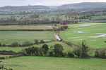
Sedgemoor services is a motorway service station on the M5 motorway near the village of Rooks Bridge in Somerset, England. The location of the services can be identified from a long distance because of their proximity to Brent Knoll, an isolated hill on the Somerset Levels. The northbound station is operated by Welcome Break, and the southbound station is operated by Roadchef. The northbound station is one of fourteen service stations for which large murals were commissioned from artist David Fisher in the 1990s, designed to reflect the local area and history.

Excerpt from the Wikipedia article Sedgemoor services (License: CC BY-SA 3.0, Authors, Images).

Sedgemoor services
M5,

Geographical coordinates (GPS) Address Nearby Places
placeShow on map

Wikipedia: Sedgemoor servicesContinue reading on Wikipedia

Geographical coordinates (GPS)

Latitude Longitude
N 51.2689 ° E -2.9215 °
placeShow on map

Address

M5
BS24 0JD
England, United Kingdom
mapOpen on Google Maps

Sedgemoor Services geograph.org.uk 1254691
Share experience

Nearby Places

Mark Yeo
Mark Yeo

The Mark Yeo is a short river or rhyne in north Somerset, England. It starts near Mark on the Somerset Levels and flows north for about 6 kilometres (4 mi) under the M5 motorway to join the River Axe near Loxton. It provided a link between the Axe and the River Brue, as part of a waterway called the "Pilrow Cut" probably canalised in the early 13th century. It no longer connects to the Brue, but is used for drainage purposes, which is unlikely to have been the case in the Middle Ages. Within the village of Mark, it is crossed by an iron bridge erected in 1824, which claims to be the oldest of its kind in the county.The river flows under the A38 road at Rooks Bridge. In the 5th and 6th centuries the Mark Yeo acted as a route from the small port of Rackley on the river Axe across the marshes to Glastonbury. It is thought to have been used to transport goods and passengers to and from Glastonbury Abbey. Excavations just north of York Farm in a field called 'Scott's Wharf' at Rooks Bridge uncovered 14th or 15th century pottery and worked stones, which represent the site of a wharf at a site where the Mark Yeo used to join the old river Axe before it was diverted.In 2008 an oil spill threatened some of the birds and other wildlife on the river. A rescue operation was launched by local volunteers to save geese, swans and ducks who were affected. The river has substantially recovered and now has a population of fish and eels.In 2015 a man was killed as a result of an accident in which a car overturned and was submerged in the Mark Yeo. Local roads were closed while the car was retrieved from the water. The driver of the car was later charged with causing death by driving without due care and attention while over the alcohol limit.