Cheddar Yeo
Axe (Bristol Channel) catchmentEngvarB from September 2013Mendip HillsNorth SomersetRivers of Somerset ... and 1 more
Somerset Levels

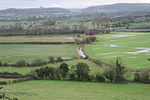
The Cheddar Yeo is a small river in Somerset, England. Beneath the limestone of the Mendip Hills it forms the largest underground river system in Britain. After emerging into Cheddar Gorge it flows through the village of Cheddar, where it has been used in the past to power mills. From the Middle Ages until the 19th century the river had ports for seagoing vessels but is no longer navigable. Some of the water, which is of good quality, is diverted into Cheddar Reservoir to provide drinking water for Bristol.
Excerpt from the Wikipedia article Cheddar Yeo (License: CC BY-SA 3.0, Authors, Images).Cheddar Yeo
Biddisham Lane,
Geographical coordinates (GPS) Address Nearby Places Show on map
Geographical coordinates (GPS)
| Latitude | Longitude |
|---|---|
| N 51.289711111111 ° | E -2.8917694444444 ° |
Address
Biddisham Lane
Biddisham Lane
BS26 2RG
England, United Kingdom
Open on Google Maps


