Rushton, Staffordshire

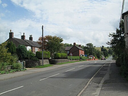
Rushton is a civil parish in Staffordshire, England. The village within the civil parish, usually known as Rushton Spencer, is about 4 miles (6.4 km) north of Leek and 7 miles (11 km) south of Macclesfield, on the A523 road which runs between these towns. The parish council does not yet have its own website; however, the Rushton Manor Courts Leet and Baron does record the proceedings of the Parish Council, which include minutes and agendas.At one time there were two adjacent civil parishes, Rushton Spencer and Rushton James. Rushton Spencer has the River Dane at its northern boundary with Cheshire, and the road crosses the river at Hugbridge; Bosley Cloud is the western boundary. To the south, separated by a stream, is Rushton James, which is bordered by Long Edge in the west, and Ryecroft Gate in the east. The parishes were amalgamated in 1934 to form Rushton civil parish.There are two public houses in the village. The Knot Inn is on Station Lane, west of the main road; it is near the former railway station and used to be called the Railway Inn. The Royal Oak is on the main road at the junction with Leek Old Road. A short distance south-east of the village, on Leek Old Road, is St Helen's Well. There is an old belief that when the well becomes dry, there will be bad times.
Excerpt from the Wikipedia article Rushton, Staffordshire (License: CC BY-SA 3.0, Authors, Images).Rushton, Staffordshire
Macclesfield Road, Staffordshire Moorlands Rushton
Geographical coordinates (GPS) Address Nearby Places Show on map
Geographical coordinates (GPS)
| Latitude | Longitude |
|---|---|
| N 53.16 ° | E -2.0934 ° |
Address
Macclesfield Road
Macclesfield Road
SK11 0SA Staffordshire Moorlands, Rushton
England, United Kingdom
Open on Google Maps


