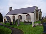
Llandyrnog
Villages in Denbighshire

Llandyrnog is a large village and community in Denbighshire, Wales lying in the valley of the River Clwyd, about 3 miles (4.8 km) from Denbigh and 5 miles (8.0 km) from Ruthin. The village has good road links to Denbigh and the main A541 road at Bodfari, and is served by buses number 76 and 53. The village contains the Church of St. Tyrnog's is a Grade II* listed building, and has a notable creamery on the outskirts and former hospital. The community includes the settlements of Waen, Ffordd-las and Llangwyfan.
Excerpt from the Wikipedia article Llandyrnog (License: CC BY-SA 3.0, Authors, Images).Llandyrnog
Church Square,
Geographical coordinates (GPS) Address Website Nearby Places Show on map
Geographical coordinates (GPS)
| Latitude | Longitude |
|---|---|
| N 53.175 ° | E -3.337 ° |
Address
Cocoa Rooms
Church Square
LL16 4HG , Llandyrnog
Wales, United Kingdom
Open on Google Maps


