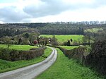
Hughley, Shropshire
Villages in Shropshire

Hughley (grid reference SO565979) is a village and civil parish in Shropshire, England, about 5 miles (8 km) south-west of Much Wenlock. It lies in the south Shropshire Hills, an Area of Outstanding Natural Beauty. The limestone escarpment Wenlock Edge is about 1 mile (1.6 km) south-east, and the parish lies on Wenlock Shale. Hughley Brook, which runs north-east along the western edge of the village, is the parish border with Church Preen (to the west of Hughley) and Kenley (to the north).
Excerpt from the Wikipedia article Hughley, Shropshire (License: CC BY-SA 3.0, Authors, Images).Hughley, Shropshire
Geographical coordinates (GPS) Address Nearby Places Show on map
Geographical coordinates (GPS)
| Latitude | Longitude |
|---|---|
| N 52.577 ° | E -2.642 ° |
Address
SY5 6NX
England, United Kingdom
Open on Google Maps


