Darp
Drenthe geography stubsPopulated places in DrentheWesterveld

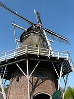
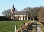
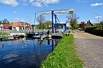
Darp is a village in the Dutch province of Drenthe. In 2001, the town of Darp had 507 inhabitants. It is a suburb of the municipality of Westerveld, and lies about 19 km west of Hoogeveen. The current name was first mentioned 1851-1855 as "sic: Erp", and means village. It used to be called Hesselte (1206 in Hesle). The reason for the name change is unclear.Much of the village was demolished in 1942 by the Germans to construct the military airfield Havelte. After 1948, part of the village was rebuilt further to the west.
Excerpt from the Wikipedia article Darp (License: CC BY-SA 3.0, Authors, Images).Darp
Schoolweg, Westerveld
Geographical coordinates (GPS) Address Nearby Places Show on map
Geographical coordinates (GPS)
| Latitude | Longitude |
|---|---|
| N 52.775 ° | E 6.2036111111111 ° |
Address
Schoolweg 14
7973 KB Westerveld
Drenthe, Netherlands
Open on Google Maps


