Schartschrofen
Allgäu AlpsMountains of Tyrol (federal state)Mountains of the AlpsOne-thousanders of Austria

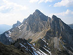
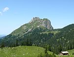
The Schartschrofen is a rocky summit, 1,968 m high, in the Tannheim Mountains, a sub-group of the Allgäu Alps. It lies northwest of the Rote Flüh and south of the col of Füssener Jöchl.
Excerpt from the Wikipedia article Schartschrofen (License: CC BY-SA 3.0, Authors, Images).Schartschrofen
Friedberger Klettersteig, Nesselwängle
Geographical coordinates (GPS) Address Nearby Places Show on map
Geographical coordinates (GPS)
| Latitude | Longitude |
|---|---|
| N 47.50306 ° | E 10.60222 ° |
Address
Friedberger Klettersteig
Friedberger Klettersteig
6672 Nesselwängle
Tyrol, Austria
Open on Google Maps


