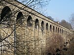
Taylor Hill, Huddersfield
AC with 0 elementsAreas of HuddersfieldHolme ValleyVillages in West Yorkshire

Taylor Hill is a semi rural/industrial urban village of the town of Huddersfield in the English county of West Yorkshire. It lies on a hill above the A616 road to Honley and Penistone and the eastern bank of the River Holme, in the Holme Valley, approximately 1.5 miles (2 km) to the south of Lockwood, west of Newsome and to the north of Berry Brow. Administratively, Taylor Hill is in the Newsome Ward of the Metropolitan Borough of Kirklees, the latter of which includes all of Huddersfield and surrounding areas.
Excerpt from the Wikipedia article Taylor Hill, Huddersfield (License: CC BY-SA 3.0, Authors, Images).Taylor Hill, Huddersfield
Taylor Hill Road, Kirklees Taylor Hill
Geographical coordinates (GPS) Address Nearby Places Show on map
Geographical coordinates (GPS)
| Latitude | Longitude |
|---|---|
| N 53.626331 ° | E -1.798475 ° |
Address
Taylor Hill Road
Taylor Hill Road
HD4 6HR Kirklees, Taylor Hill
England, United Kingdom
Open on Google Maps


