place

Lockwood railway station
DfT Category F2 stationsFormer Lancashire and Yorkshire Railway stationsNorthern franchise railway stationsRailway stations in Great Britain opened in 1850Railway stations in Huddersfield
Use British English from March 2017
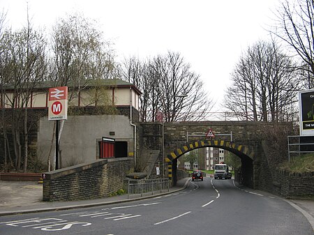
Lockwood railway station (Geograph 1824673 by Stephen Armstrong)

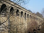
Lockwood railway station is a railway station in Huddersfield, England. It is situated 1.5 miles (2 km) south of Huddersfield station on the Penistone Line between Huddersfield and Sheffield. It serves the Lockwood district of Huddersfield, and services are provided by Northern. The station comprises a single side platform alongside the single-line of the railway, although the remains of a second platform alongside the site of the former second track (removed in 1989) are still visible. To the south of the station, the line to Sheffield passes over the valley of the River Holme by an impressive 476 yards (435 m) long stone viaduct to Berry Brow. Below the 122 feet (37 m) high structure is the Huddersfield Rugby Union Club ground at Lockwood Park, which was formerly a Bass Brewery. The former Meltham branch line branched off the main line just before the viaduct. This line closed to passengers in 1949 and to freight in 1965. To the north, the route passes through a short tunnel then crosses another large viaduct across the River Colne before joining the main line at Springwood Junction.

Excerpt from the Wikipedia article Lockwood railway station (License: CC BY-SA 3.0, Authors, Images).

Lockwood railway station
Swan Lane, Kirklees Lockwood

Geographical coordinates (GPS) Address External links Nearby Places
placeShow on map

Wikipedia: Lockwood railway stationContinue reading on Wikipedia

Geographical coordinates (GPS)

Latitude Longitude
N 53.63479 ° E -1.8008 °
placeShow on map

Address

Lockwood

Swan Lane
HD1 3UE Kirklees, Lockwood
England, United Kingdom
mapOpen on Google Maps

linkWikiData (Q6665908)
linkOpenStreetMap (21625394)

Lockwood railway station (Geograph 1824673 by Stephen Armstrong)
Share experience

Nearby Places

Longroyd Bridge
Longroyd Bridge

Longroyd Bridge is a suburb approximately 1200 yds (1.1 km) to the southwest of Huddersfield town centre, West Yorkshire, England. The area is composed of industrial and commercial units. There is little housing in the commercial area, though within a few hundred yards are the housing areas of Thornton Lodge and Paddock. The dominating feature of the area is the viaduct carrying the Sheffield—Huddersfield Penistone Line railway over the valley of the River Colne from the station at Lockwood to Springwood Junction and tunnel where the line continues under Greenhead to arrive at Huddersfield railway station. Longroyd Bridge is where the A62, Manchester Road, route to Manchester passes over the Huddersfield Narrow Canal and the River Colne, it then travels down through the Colne Valley passing Milnsbridge, Linthwaite, and Slaithwaite to Marsden before crossing the Pennine hills to Oldham and Manchester. The Huddersfield Narrow canal has been extensively reconstructed over the last few years, with long infilled stretches dug out again. In places this has required major civil engineering work to route the canal under buildings that had been constructed over the canal when it became disused. Also to replace newly constructed lock gates. Within the first year after re-opening the canal drained out, unexpectedly, leaving some narrowboats and leisure craft stranded for several days. Then again in early 2009 there was a leak, which again stranded boats.