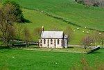
West Dorset
2019 disestablishments in EnglandFormer non-metropolitan districts of DorsetPages with non-numeric formatnum argumentsUse British English from June 2019West Dorset District

West Dorset was a local government district in Dorset, England. The district was formed on 1 April 1974 under the Local Government Act 1972, and was a merger of the boroughs of Bridport, Dorchester and Lyme Regis, along with Sherborne urban district and the rural districts of Beaminster, Bridport, Dorchester and Sherborne. Its council was based in Dorchester. The district and its council were abolished on 1 April 2019 and, together with the other four districts outside the greater Bournemouth area, replaced by a new Dorset unitary authority.
Excerpt from the Wikipedia article West Dorset (License: CC BY-SA 3.0, Authors, Images).West Dorset
Higher Drove,
Geographical coordinates (GPS) Address Nearby Places Show on map
Geographical coordinates (GPS)
| Latitude | Longitude |
|---|---|
| N 50.79 ° | E -2.6 ° |
Address
Higher Drove
Higher Drove
DT2 0HU
England, United Kingdom
Open on Google Maps


