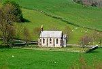
Toller Porcorum
Dorset geography stubsVillages in Dorset

Toller Porcorum () is a village and civil parish in Dorset, England, situated in the Toller valley 10 miles (16 km) northwest of Dorchester. In the 2011 census the civil parish—which also includes the small settlements of Higher and Lower Kingcombe to the north—had a population of 307.
Excerpt from the Wikipedia article Toller Porcorum (License: CC BY-SA 3.0, Authors, Images).Toller Porcorum
School Lane,
Geographical coordinates (GPS) Address Nearby Places Show on map
Geographical coordinates (GPS)
| Latitude | Longitude |
|---|---|
| N 50.7795 ° | E -2.6218 ° |
Address
School Lane
School Lane
DT2 0DF , Toller Porcorum
England, United Kingdom
Open on Google Maps


