place

Thurso Castle

1872 establishments in Scotland1952 disestablishments in ScotlandBuildings and structures completed in 1872Ruined castles in CaithnessRuined castles in Highland (council area)
Thurso
Thurso Castle 20090614 02

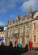
Thurso Castle (alternatively, Castrum De Thorsa, Castle of Ormly, and Castle of Ormlie) is a ruined 19th-century castle, located in Thurso, Caithness, in the Scottish Highlands. Situated in Thurso East, off Castletown Road, east of the River Thurso, the site can be seen from across the river. The current castle ruins date to 1872; A large part was demolished in 1952, although there has been a fortress here since the 12th century. Part of the castle is still habitable and remains a home of the Viscounts Thurso.

Excerpt from the Wikipedia article Thurso Castle (License: CC BY-SA 3.0, Authors, Images).

Thurso Castle
Sir Archibald Road,

Geographical coordinates (GPS) Address External links Nearby Places
placeShow on map

Wikipedia: Thurso CastleContinue reading on Wikipedia

Geographical coordinates (GPS)

Latitude Longitude
N 58.599294444444 ° E -3.5082083333333 °
placeShow on map

Address

Thurso Castle

Sir Archibald Road
KW14 8HN , Mount Pleasant
Scotland, United Kingdom
mapOpen on Google Maps

linkWikiData (Q2745807)
linkOpenStreetMap (232569919)

Thurso Castle 20090614 02
Share experience

Nearby Places

River Thurso
River Thurso

The River Thurso (Scottish Gaelic: Abhainn Theòrsa) has Loch Rumsdale in Caithness as its source, about 26 kilometres south and 14 kilometres west of the burgh of Thurso, Caithness, and about 2 kilometres south of the railway line linking the burghs of Thurso and Wick with Inverness. At its source and until it reaches Loch More the river is known also as Strathmore Water. Caithness is in the Highland area of Scotland. From Loch Rumsdale the river flows generally east/southeast across about 4 kilometres until it is joined by Glutt Water, and then generally northeast across about 7 kilometres until it enters the southern end of Loch More. On the loch's eastern side, towards its northern end, the river flows almost immediately into the western end of Loch Beg. Then from Loch Beg's eastern end the river flows east/northeast across about 6 kilometres until it is joined by Little River. From Little River the River Thurso flows generally northward across about 19 kilometres until it reaches its mouth in Thurso Bay and the Atlantic Ocean. On its way it passes through the village of Halkirk, about 9 kilometres south of the burgh of Thurso, and through the burgh itself, which fronts the bay. The river is bridged twice by railways, three times each by highways and footways. About 4 kilometres south of Thurso burgh the river is bridged by the rail link between the burghs of Wick and Thurso. About 6 kilometres further south it is bridged by the rail link connecting both burghs with Inverness. The highways cross the river in the burgh of Thurso, in Halkirk, and at Westerdale, which is about 16 kilometres south of the burgh. The three footway crossings were within the burgh of Thurso.

Thurso
Thurso

Thurso (pronounced ; Scots: Thursa, Scottish Gaelic: Inbhir Theòrsa [ˈiɲɪɾʲ ˈhjɔːrˠs̪ə]) is a town and former burgh on the north coast of the Highland council area of Scotland. Situated in the historical County of Caithness, it is the northernmost town on the island of Great Britain. From a latitudinal standpoint, Thurso is located further north than the southernmost point of Norway and in addition lies more than 500 miles (800 km) north of London.It lies at the junction of the north–south A9 road and the west–east A836 road, connected to Bridge of Forss in the west and Castletown in the east. The 34-mile (55 km) River Thurso flows through the town and into Thurso Bay and the Pentland Firth. The river estuary serves as a small harbour. At the 2011 Census, Thurso had a population of 7,933. The population of the larger Thurso civil parish including the town and the surrounding countryside was estimated to be 12,057 in 2021.Thurso functioned as an important Norse port, and later traded with ports throughout northern Europe until the 19th century. A thriving fishing centre, Thurso also had a reputation for its linen-cloth and tanning activities. As of 2015, the Dounreay Nuclear Research Establishment, although mostly decommissioned at the end of the 20th century, employs a significant number of the local population. The Category-A listed ruined Old St Peter's Church (St. Peter's Kirk) is one of the oldest churches in Scotland, dating to at least 1125. The current church, St Andrew's and St Peter's, was built in 1832 to a design by William Burn in the Gothic style. The town contains the main campus of North Highland College and Thurso High School, the northernmost secondary school on the British mainland, which was established in 1958. Thurso Castle, built in 1872, is in ruins. Thurso is home to the football team Thurso FC, established in 1998, who play in the North Caledonian League, and the rugby teams Caithness Crushers and Caithness RFC. Thurso railway station, opened in 1874, is the most northern station in the United Kingdom. The nearby port of Scrabster provides ferry services to the Orkney Islands; the NorthLink ferry (MV Hamnavoe) operates between Scrabster and Stromness.