Thurso

Thurso (pronounced ; Scots: Thursa, Scottish Gaelic: Inbhir Theòrsa [ˈiɲɪɾʲ ˈhjɔːrˠs̪ə]) is a town and former burgh on the north coast of the Highland council area of Scotland. Situated in the historical County of Caithness, it is the northernmost town on the island of Great Britain. From a latitudinal standpoint, Thurso is located further north than the southernmost point of Norway and in addition lies more than 500 miles (800 km) north of London.It lies at the junction of the north–south A9 road and the west–east A836 road, connected to Bridge of Forss in the west and Castletown in the east. The 34-mile (55 km) River Thurso flows through the town and into Thurso Bay and the Pentland Firth. The river estuary serves as a small harbour. At the 2011 Census, Thurso had a population of 7,933. The population of the larger Thurso civil parish including the town and the surrounding countryside was estimated to be 12,057 in 2021.Thurso functioned as an important Norse port, and later traded with ports throughout northern Europe until the 19th century. A thriving fishing centre, Thurso also had a reputation for its linen-cloth and tanning activities. As of 2015, the Dounreay Nuclear Research Establishment, although mostly decommissioned at the end of the 20th century, employs a significant number of the local population. The Category-A listed ruined Old St Peter's Church (St. Peter's Kirk) is one of the oldest churches in Scotland, dating to at least 1125. The current church, St Andrew's and St Peter's, was built in 1832 to a design by William Burn in the Gothic style. The town contains the main campus of North Highland College and Thurso High School, the northernmost secondary school on the British mainland, which was established in 1958. Thurso Castle, built in 1872, is in ruins. Thurso is home to the football team Thurso FC, established in 1998, who play in the North Caledonian League, and the rugby teams Caithness Crushers and Caithness RFC. Thurso railway station, opened in 1874, is the most northern station in the United Kingdom. The nearby port of Scrabster provides ferry services to the Orkney Islands; the NorthLink ferry (MV Hamnavoe) operates between Scrabster and Stromness.
Excerpt from the Wikipedia article Thurso (License: CC BY-SA 3.0, Authors, Images).Thurso
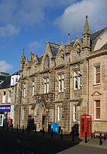
Bank Street,
Geographical coordinates (GPS) Address Nearby Places Show on map
 Continue reading on Wikipedia
 Geographical coordinates (GPS)
| Latitude | Longitude |
|---|---|
| N 58.596 ° | E -3.521 ° |
Address
Bank Street
Bank Street
KW14 8BG , Mount Vernon
Scotland, United Kingdom
Open on Google Maps