place

Bilstone

Former civil parishes in LeicestershireShackerstoneUse British English from December 2014Villages in Leicestershire
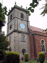
Twycross Road in Bilstone geograph.org.uk 926274

Bilstone is a small village and former civil parish, now in the parish of Shackerstone, in the Hinckley and Bosworth district of Leicestershire, England. It is approximately 12 miles (19 km) west from the county town and city of Leicester, and 2 miles (3.2 km) east from Twycross and the A444 road. In 1931 the parish had a population of 68.The village's name means 'farm/settlement of Bildr' or 'farm/settlement on a corner or angle'.A half mile to the south, on Gibbet Lane, is a gibbet post, dating from 1800. The post was close to a contemporary murder. At the west of the village is a Grade II listed early 19th-century farmhouse. At the north of the village on Mill Lane is a disused 18th-century watermill, with adjoined 19th-century buildings. The mill was operational in the 1950s; today its machinery doesn't exist.Bilstone is listed in the Domesday Book as in the Guthlaxton Hundred of Leicestershire, with two ploughlands, three households and three freemen. In 1066 Countess Godiva was Lord, she remaining as such in 1086, also becoming Tenant-in-chief to William I.In 1870-1872 Bilston was a township in the parish of Norton Juxta Twycross with a population of 116 and 25 houses.In 1866 Bilstone became a parish in its own right, on 1 April 1935 the parish was abolished and merged with Shackerstone.John Grundy, Sr., land surveyor and civil engineer, was born in Bilstone c. 1696.

Excerpt from the Wikipedia article Bilstone (License: CC BY-SA 3.0, Authors, Images).

Bilstone
Main Road, Hinckley and Bosworth

Geographical coordinates (GPS) Address Nearby Places
placeShow on map

Wikipedia: BilstoneContinue reading on Wikipedia

Geographical coordinates (GPS)

Latitude Longitude
N 52.6446 ° E -1.46524 °
placeShow on map

Address

Main Road

Main Road
CV13 6NG Hinckley and Bosworth
England, United Kingdom
mapOpen on Google Maps

Twycross Road in Bilstone geograph.org.uk 926274
Share experience

Nearby Places

Newton Burgoland
Newton Burgoland

Newton Burgoland is a village in the civil parish of Swepstone and Newton Burgoland, in the North West Leicestershire district of Leicestershire, England. The Swepstone parish used to include a small settlement named Newton-Nethercote, which formed part of the village, but that is now part of the rest of Newton Burgoland. The population is included in the civil parish of Swepstone. The place-name is first attested in the Domesday Book of 1086, where it appears as Neutone. It is referred to as Neuton Burgilon in 1390. The name "Newton" means "new homestead or village". The "Burgoland" element refers to the Burgilon family, the name meaning "Burgundian".The village contains a public house, "The Belper Arms", which is identified as the oldest pub in Leicestershire. The pub dates back to 1290 when which it was named "The Shepherd and the Shepherdess Inn". During the Second World War, the village was highly affected by German bombing which took place in surrounding villages such as Odstone, Measham and Heather. In 1940, evacuees were escorted to the village notably from Coventry, Birmingham and London to escape the bombing in such cities. Nearby Gopsall Hall was later requisitioned as a barracks for British soldiers during the war, who visited public houses in Newton Burgoland such as "The Belper Arms" and "The Spade Tree". The village contains a primary school situated on School Lane. Children attending the school typically transfer when aged 11 to Ibstock Community College, The Market Bosworth School or elsewhere. The famous cinema and church organ builder, John Compton, was born in Newton Burgoland.