Agoura, California
1871 establishments in CaliforniaConejo ValleyNeighborhoods in Agoura Hills, CaliforniaPopulated places established in 1871Populated places in the Santa Monica Mountains ... and 3 more
Unincorporated communities in CaliforniaUnincorporated communities in Los Angeles County, CaliforniaUse mdy dates from July 2023

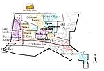
Agoura () is an unincorporated community of Los Angeles County, which is located southeast of the city of Agoura Hills, California, adjacent to the city of Calabasas in Los Angeles County. Agoura was the historical name of the area, before much of the area was developed and before the incorporation of the city of Agoura Hills. There are a few nearby pockets of unincorporated areas that contain a handful of houses. Much of the area is also often referred to as the neighborhood of Old Agoura. The ZIP code is 91301 and the area codes are 747 and 818.
Excerpt from the Wikipedia article Agoura, California (License: CC BY-SA 3.0, Authors, Images).Agoura, California
Ventura Freeway,
Geographical coordinates (GPS) Address Nearby Places Show on map
Geographical coordinates (GPS)
| Latitude | Longitude |
|---|---|
| N 34.143055555556 ° | E -118.73694444444 ° |
Address
Ventura Freeway
Ventura Freeway
91301
California, United States
Open on Google Maps


