River Bourne, Warwickshire
Rivers of WarwickshireTame catchmentUse British English from January 2018

The River Bourne flows for 10.9 miles (17.6 km) through North Warwickshire, England, and is a tributary of the River Tame. In the 19th century, the river with its undeveloped catchment close to Birmingham, was selected to provide a source of clean drinking water for the city.
Excerpt from the Wikipedia article River Bourne, Warwickshire (License: CC BY-SA 3.0, Authors, Images).River Bourne, Warwickshire
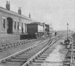
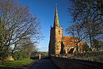
Station Road, North Warwickshire Nether Whitacre CP
Geographical coordinates (GPS) Address Nearby Places Show on map
Geographical coordinates (GPS)
| Latitude | Longitude |
|---|---|
| N 52.5217 ° | E -1.6834 ° |
Address
Station Road
B46 2BY North Warwickshire, Nether Whitacre CP
England, United Kingdom
Open on Google Maps


