place

River Cole, West Midlands

Coleshill, WarwickshireGeographic coordinate listsLists of coordinatesRivers of WarwickshireRivers of Worcestershire
Rivers of the West Midlands (county)Tame catchmentUse British English from March 2015
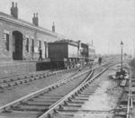
River Cole, Coleshill geograph.org.uk 159500

The River Cole is a 25 miles (40 km) river in the English Midlands. It rises on the lower slopes of Forhill, one of the south-western ramparts of the Birmingham Plateau, at Red Hill and flows south before flowing largely north-east across the plateau to enter the River Blythe below Coleshill, near Ladywalk, shortly before the Blythe meets the Tame. This then joins the Trent, whose waters reach the North Sea via the Humber Estuary. Its source is very near the main watershed of Midland England : tributaries are few and very short except in the lower reaches, so the Cole is only a small stream.

Excerpt from the Wikipedia article River Cole, West Midlands (License: CC BY-SA 3.0, Authors, Images).

River Cole, West Midlands
Fishery Lane, North Warwickshire

Geographical coordinates (GPS) Address Nearby Places
placeShow on map

Wikipedia: River Cole, West MidlandsContinue reading on Wikipedia

Geographical coordinates (GPS)

Latitude Longitude
N 52.518055555556 ° E -1.6888888888889 °
placeShow on map

Address

Whitacre Water Treatment Works

Fishery Lane
B46 2BY North Warwickshire
England, United Kingdom
mapOpen on Google Maps

River Cole, Coleshill geograph.org.uk 159500
Share experience

Nearby Places

Pumping Station, Whitacre Waterworks

The Pumping Station at Whitacre Waterworks, Shustoke, Warwickshire, is a Victorian Civic Gospel pumping house built in circa 1872. Along with the construction of Shustoke Reservoir, it was originally designed to pump six million gallons of fresh water per day to nearby Birmingham. It started operating in 1883, but was shortly thereafter in 1904 put into standby as the Elan Valley reservoirs and aqueduct scheme started to supply Birmingham with its freshwater needs. It instead was latterly used in 1908 to supply water to Coventry, and now Nuneaton, Atherstone, and Bedworth. The water supply emanates from the nearby river Bourne and the river Blythe. The pumping station building was listed grade II* in March 1982 as a notable example of civic gospel. The listing also covers a Victorian filter house, water well, and Superintendent's house. In 2018 the unused building was placed on Historic England's Heritage at Risk Register due to its poor condition and prioritised as in immediate risk of further rapid deterioration.The pumping station and reservoir originally belonged to the Water Department of the City of Birmingham, but now they are the responsibility of Severn Trent Water. The reservoir is a popular leisure site for sailing and walking. Apart from the two clocks, the original pumping machinery and ancillaries have largely been dismantled and replaced with modern equipment. The site was largely extended in 1977 with new more modern works. It is believed to originally have contained two beam engines by James Watt, one of which is now on display in the Science Museum, Birmingham.