place

Flagg, Derbyshire

Derbyshire DalesDerbyshire geography stubsTowns and villages of the Peak DistrictVillages in Derbyshire
Flagg Methodist Chapel photoshopped 165068

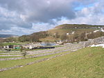
Flagg (Old Norse A sod of peat) is a small Peak District village and civil parish, set in the Derbyshire Dales, halfway between the small market town of Bakewell and the spa town of Buxton, in the area known as the White Peak. The population of the civil parish as taken at the 2011 Census was 192.Flagg is predominantly a farming village. As well as farms, houses and cottages, Flagg has an Elizabethan manor house, Flagg Hall, which is not open to the public. There is a caravan/campsite within its grounds. The former Unitarian church, built in 1838, is now a private dwelling. A Methodist chapel is also situated in the village. It was completed in 1839. Next to the chapel is the former village school, now a nursery school. 1000 feet above sea level, Flagg is recorded in the Domesday Book as "Flagun", and is believed to have originally been a Viking settlement engaged primarily in lead mining, the evidence of which can still be seen today with many spoil heaps and disused mine shafts in the area. In the mid-19th century, well dressings were held during "Wakes Week", which was always begun on the first Sunday after June 24. There were two wells, one opposite to Ivy House Farm, and the other opposite to Edge Close Farm. Flagg is known for the point-to-point races held annually on Easter Tuesday by the High Peak Hunt. On one occasion, King Edward VIII, the then Prince of Wales, rode at the races. The village is also popular with hikers and campers, having numerous walks within or close to its boundaries, and several campsites catering for tents, caravans, and motorhomes.

Excerpt from the Wikipedia article Flagg, Derbyshire (License: CC BY-SA 3.0, Authors, Images).

Flagg, Derbyshire
Mycock Lane, Derbyshire Dales

Geographical coordinates (GPS) Address Nearby Places
placeShow on map

Wikipedia: Flagg, DerbyshireContinue reading on Wikipedia

Geographical coordinates (GPS)

Latitude Longitude
N 53.212 ° E -1.797 °
placeShow on map

Address

Mycock Lane

Mycock Lane
SK17 9ED Derbyshire Dales
England, United Kingdom
mapOpen on Google Maps

Flagg Methodist Chapel photoshopped 165068
Share experience

Nearby Places

Taddington
Taddington

Taddington is a village and civil parish in Derbyshire, England. The population of the civil parish, together with neighbouring Blackwell in the Peak and Brushfield parishes, as taken at the 2011 census, was 457. It lies over 1,100 feet (340 m) above sea level, on the former A6 road between Buxton and Bakewell, in the Derbyshire Dales district. To the east, the A6 runs through Taddington Dale, while Taddington Moor lies to the west. Taddington grew around farming and quarrying for limestone and lead. From 1863 to 1967 the village was served by Millers Dale railway station, some two miles away, which was on the Midland Railway's extension of the Manchester, Buxton, Matlock and Midlands Junction Railway.The village's main attractions are the Five Wells chambered tomb topped by a cairn, and the 14th-century church, with the remains of a 7th-century Celtic cross in the churchyard. The two-metre cross shaft is decorated with an unusual chevron-based pattern. It was at one time used to support a sink in the wall of a nearby public house. A further possible cross base lies in the churchyard.Notable buildings include Taddington Manor and Marlborough House. Fields around the settlement show evidence of both Celtic lynchett terraces, and of mediaeval strip farming. Taddington has two pubs, the Queens Arms and the Waterloo. In 2009 the Queens Arms opened a convenience store in the pub's pool room. There is an annual well dressing focused on the "High Well", unusually lying above the village.

Chelmorton
Chelmorton

Chelmorton is a village and a civil parish in Derbyshire, England. It is in the Derbyshire Dales district and the nearest towns are Buxton to the northwest and Bakewell to the east. The name Chelmorton derives from Old English (a personal name + dūn) and probably means 'Ceolmaer's hill' (or 'Cēolmær's hill'). The population of the civil parish as of the 2011 census was 322.Chelmorton village lines a long street in a high, shallow basin on a limestone plateau, part of the White Peak area of the Peak District National Park. The village is surrounded by a regular pattern of rectangular fields that are bordered by limestone walls; the layout of these indicates that the village had one or possibly two medieval open fields, before enclosure occurred at a subsequent unspecified time.In the 12th century the village was known as Chelmerdon(e). The parish church of Saint John the Baptist is 11th century. At the opposite end of the village stands its oldest dwelling, Townend Farm, built originally by Isaiah Buxton in 1634. With its four Venetian windows and pedimented doorway it is also known locally as Chelmorton Hall. This ancestral home and family seat of the Marsden family has an enclosed courtyard with elaborate outbuildings. The Church Inn is at the bottom of Chelmorton Low. Other sites of interest are the Rakes, and the source of the village's traditional water supply, Illy Willy Water. Children from Chelmorton go to Harpur Hill Primary School, Buxton Community School, Monyash Primary School and Lady Manners School.