place

Five Wells

Archaeological sites in DerbyshireBuildings and structures in DerbyshireDerbyshire DalesMegalithic monuments in EnglandScheduled monuments in Derbyshire
Stone Age sites in EnglandTombs in the United KingdomTourist attractions in Derbyshire
Fivewells Chambered Cairn geograph.org.uk 1213011

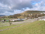
Five Wells is a Neolithic chambered tomb between the villages of Chelmorton and Taddington on Taddington Moor in the Derbyshire Peak District in England. The tomb is a protected scheduled ancient monument. Three stones mark the main chamber, which has been dramatically reduced; a second less well-preserved chamber is to the west. The burial mound is over 20 metres (66 ft) in diameter and was first excavated by the local archaeologist Thomas Bateman in 1846. The chambers have paved floors. Bateman discovered the remains of at least twelve human skeletons. Subsequent excavations (by Llewellyn Jewitt, William Lukis and Micah Salt between 1862 and 1901) found further human remains, pottery and flint tools in the chambers and passages and a separate cist (stone coffin) within the mound.Access can be made on foot via a permitted path from Pillwell Gate to the west. Access along the permitted path can also be made from the Limestone Way long-distance footpath, which runs along Sough Lane 500 metres (550 yd) to the east.

Excerpt from the Wikipedia article Five Wells (License: CC BY-SA 3.0, Authors, Images).

Five Wells
Senners Lane, Derbyshire Dales

Geographical coordinates (GPS) Address External links Nearby Places
placeShow on map

Wikipedia: Five WellsContinue reading on Wikipedia

Geographical coordinates (GPS)

Latitude Longitude
N 53.23626 ° E -1.81595 °
placeShow on map

Address

Five Wells

Senners Lane
SK17 9TH Derbyshire Dales
England, United Kingdom
mapOpen on Google Maps

linkWikiData (Q1421895)
linkOpenStreetMap (332792502)

Fivewells Chambered Cairn geograph.org.uk 1213011
Share experience

Nearby Places

Chee Dale
Chee Dale

Chee Dale is a steep-sided gorge on the River Wye near Buxton, Derbyshire, in the Peak District of England. The Wye valley continues upstream towards Buxton as Wye Dale, while downstream are Miller's Dale village and valley.Chee Dale has a protected nature reserve (close to the village of Wormhill), which is overseen by the Derbyshire Wildlife Trust. The reserve contains ash, yew and rock whitebeam woodland on the cliff sides and abundant wild flowers including cowslips, early purple orchids, rock rose and the rare Jacob's ladder. Dippers are often seen darting low above the river and bobbing on rocks in the river. Other birds nesting in the valley include blackcap, chiffchaff and willow warbler. Chee Dale is part of the Wye Valley Site of Special Scientific Interest (SSSI), running for 15 kilometres (9.3 mi) east of Buxton. The Monsal Trail bridleway runs for 8.5 miles (13.7 km) from Topley Pike Junction (at the head of Chee Dale) to Rowsley near Bakewell, along the disused Manchester, Buxton, Matlock and Midlands Junction Railway line. It passes through Upper Chee Dale and then enters Chee Tor Tunnels 1 and 2 through to Miller's Dale.There is also a riverside footpath along the length of Chee Dale with several wooden footbridges over the river. Sets of stepping stones allow walkers to pass the foot of the cliffs.The crags of carboniferous limestone in Upper Chee Dale and of Chee Tor cliff in Lower Chee Dale have extensive rock climbing routes. These include the overhanging Cornice and Chee Tor. Chee Tor has the Chee Tor Girdle route, a 167-metre (548 ft) horizontal traverse 20 metres (66 ft) above the cliff base, first climbed in 1964 by Chris Jackson and J. Atkinson.At the head of Chee Dale, Great Rocks Dale enters from the north, at the former railway stations of Blackwell Mill and Chee Dale Halt. Great Rocks Dale is a dry valley and is the site of Tunstead Quarry, one of the largest limestone quarries in the UK.The Pennine Bridleway crosses the River Wye over a footbridge at Blackwell Mill. Access into the deep gorge is limited. Miller's Dale car park is the obvious place for visitors to get into Chee Dale. At the west end of Chee Dale there is Topley Pike layby with limited parking by the A6 road. There is also a short steep footpath into Chee Dale from Wormhill.

Chelmorton
Chelmorton

Chelmorton is a village and a civil parish in Derbyshire, England. It is in the Derbyshire Dales district and the nearest towns are Buxton to the northwest and Bakewell to the east. The name Chelmorton derives from Old English (a personal name + dūn) and probably means 'Ceolmaer's hill' (or 'Cēolmær's hill'). The population of the civil parish as of the 2011 census was 322.Chelmorton village lines a long street in a high, shallow basin on a limestone plateau, part of the White Peak area of the Peak District National Park. The village is surrounded by a regular pattern of rectangular fields that are bordered by limestone walls; the layout of these indicates that the village had one or possibly two medieval open fields, before enclosure occurred at a subsequent unspecified time.In the 12th century the village was known as Chelmerdon(e). The parish church of Saint John the Baptist is 11th century. At the opposite end of the village stands its oldest dwelling, Townend Farm, built originally by Isaiah Buxton in 1634. With its four Venetian windows and pedimented doorway it is also known locally as Chelmorton Hall. This ancestral home and family seat of the Marsden family has an enclosed courtyard with elaborate outbuildings. The Church Inn is at the bottom of Chelmorton Low. Other sites of interest are the Rakes, and the source of the village's traditional water supply, Illy Willy Water. Children from Chelmorton go to Harpur Hill Primary School, Buxton Community School, Monyash Primary School and Lady Manners School.

Blackwell Mill
Blackwell Mill

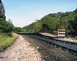
Blackwell Mill is a location in Derbyshire, near to the village of Blackwell near Buxton, but not part of it. There was once a corn mill on the River Wye which may have dated from 1066. Most of it has disappeared, apart from the weir. What is left is marked as an Ancient Monument. It stands at the meeting point of several valleys: Great Rocks Dale, Chee Dale and Ashford Dale. In times past the Manchester Turnpike forded the river. It marks the northern end of the public path from Bakewell, used by walkers and cyclists, called the Monsal Trail. The trail follows the trackbed of the former Midland Railway main line from London to Manchester. Blackwell Mill lies between Bakewell and Buxton, on the Midland's attempt to extend the Manchester, Buxton, Matlock and Midlands Junction Railway into Manchester. This point was the south curve of the triangular junction which it built when it, instead, extended to New Mills. There was a railway station variously called "Blackwell Mill" or "Blackwell Mill Halt". Long enough only for one carriage, it was reputed to be the smallest passenger station on British Railways. It consisted of two short platforms, with no buildings, apart from a small shelter, which although derelict is still standing despite. The station was last used in June 1966 and officially closed in 1967. The halt was for the railway workers who lived in the still-existing, and still occupied, eight terraced cottages nearby in the valley. The station was also included in a Pathé News film in 1938.Passengers and goods from Buxton wishing to transfer to or from the Midland Main Line travelled past this point, to then change trains at Millers Dale. The branch carried on into Buxton along Wye Dale, crossing the main A6 road and the river by a high twin-arched girder bridge, before entering Pig Tor Tunnel (191 yards), where it emerged into Ashwood Dale, followed by the 100-yard (91 m) Ashwood Dale Tunnel.

Taddington
Taddington

Taddington is a village and civil parish in Derbyshire, England. The population of the civil parish, together with neighbouring Blackwell in the Peak and Brushfield parishes, as taken at the 2011 census, was 457. It lies over 1,100 feet (340 m) above sea level, on the former A6 road between Buxton and Bakewell, in the Derbyshire Dales district. To the east, the A6 runs through Taddington Dale, while Taddington Moor lies to the west. Taddington grew around farming and quarrying for limestone and lead. From 1863 to 1967 the village was served by Millers Dale railway station, some two miles away, which was on the Midland Railway's extension of the Manchester, Buxton, Matlock and Midlands Junction Railway.The village's main attractions are the Five Wells chambered tomb topped by a cairn, and the 14th-century church, with the remains of a 7th-century Celtic cross in the churchyard. The two-metre cross shaft is decorated with an unusual chevron-based pattern. It was at one time used to support a sink in the wall of a nearby public house. A further possible cross base lies in the churchyard.Notable buildings include Taddington Manor and Marlborough House. Fields around the settlement show evidence of both Celtic lynchett terraces, and of mediaeval strip farming. Taddington has two pubs, the Queens Arms and the Waterloo. In 2009 the Queens Arms opened a convenience store in the pub's pool room. There is an annual well dressing focused on the "High Well", unusually lying above the village.