place

Gumihorn

Bernese AlpsCanton of Bern mountain stubsMountains of SwitzerlandMountains of the AlpsMountains of the canton of Bern
Two-thousanders of Switzerland
Schynige Platte, with view of Gummihorn and Jungfrau, Bernese Oberland, Switzerland LCCN2001701329

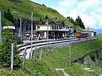
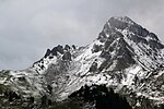
The Gumihorn is a mountain of the Bernese Alps, the highest point of the Schynige Platte ridge, located at the western end of the Schwarzhorn group. It forms a limestone tower, overlooking the valley of the Lütschine. At 2,099 metres (6,886 ft), it is the highest summit lying west of the Loucherhorn. The Gumihorn lies between the municipalities of Gsteigwiler and Gündlischwand, in the canton of Bern. Although its summit cannot be easily climbed, two other slightly lower summits on both sides of the peak can be easily reached from the Schynige Platte railway station, hence allowing a 360-degree view of the region. The highest is named Tuba or Daube (2,076 m; to the north) and the other, directly above the railway station, is named Geiss (2,067 m; to the south).

Excerpt from the Wikipedia article Gumihorn (License: CC BY-SA 3.0, Authors, Images).

Geographical coordinates (GPS)

Latitude Longitude
N 46.655277777778 ° E 7.9080555555556 °
placeShow on map

Address

Panoramaweg
3814
Bern, Switzerland
mapOpen on Google Maps

Schynige Platte, with view of Gummihorn and Jungfrau, Bernese Oberland, Switzerland LCCN2001701329
Share experience

Nearby Places

Schynige Platte
Schynige Platte

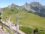
The Schynige Platte (Scheinige Platte on the old Siegfried Map) is a small mountain ridge and a viewpoint in the Bernese Highlands and belongs to the Schwarzhorn group. The mountain range consists of three peaks: Gumihorn (2,099 m (6,886 ft)), Tuba (2,076 m (6,811 ft)), and the closest summit next to the viewpoint, Geiss (2,067 metres (6,781 ft)). The viewpoint lies at an altitude of about 2,000 metres (7,000 ft), at the western end of a prominent ridge of the Schwarzhorn group, which separates the valley of the Schwarze Lütschine from Lake Brienz. It is notable for its hotel and, since 1893, its mountain railway, one of the highest in Switzerland. In good weather conditions there are views to many surrounding mountains, including the Eiger, Mönch, Jungfrau, and others giants of the Bernese Alps. Also, the town of Interlaken and the two great lakes of Thun and Brienz are visible to the north, 1,500 metres (4,900 ft) lower. The area is accessible via the Schynige Platte railway, which runs from Wilderswil, where connection is made with Bernese Oberland railway trains from Interlaken. The railway reaches a height of 1,967 metres (6,453 ft) at the terminus station, on the south-facing slopes of Geiss summit. Southwest of the station is a hotel and mountain restaurant, at a height of 1,983 metres (6,506 ft). Northeast of the station is the Schynige Platte alpine botanical garden, specialising in the display of, and research into, the high altitude flora of Switzerland. A number of short loop trails extend north from the train station, reaching several view points, all within one kilometre from each other. Directly above the station and hotel, and overlooking the valleys of Lauterbrunnen and Grindelwald, is the Geiss summit (2,067 metres (6,781 ft)). Further north, and overlooking Interlaken and the two great lakes, are the Tuba (2,076 metres (6,811 ft)) and Oberberghorn (2,069 metres (6,788 ft)) summits. The highest summit in the Schynige Platte area, between the Daube and Geiss summits, the tower-like Gumihorn peak (2,099 metres (6,886 ft)), cannot be reached by pedestrians. The Schynige Platte is also the starting point for the popular hiking trails to Loucherhorn, Faulhorn or First which is connected to Grindelwald by a gondola lift. Administratively, the area is shared between the municipalities of Gündlischwand and Gsteigwiler, the tripoint between the municipalities of Bönigen, Gündlischwand and Gsteigwiler being on the Tuba summit. All the municipalities are in the canton of Bern.

Schynige Platte Alpine Garden

The Schynige Platte Alpine Garden (German: Alpengarten Schynige Platte) is a botanical garden located at an altitude of about 2,000 metres (7,000 ft), near the summit of the Schynige Platte mountain in the Bernese Oberland region of Switzerland. It specialises in research into the high altitude flora of Switzerland, and has a display of over 600 species of plants native to the Swiss Alps. The garden is run by the Schynige Platte Alpine Garden Society, working closely with the Botanical Garden of Bern and the Institute for Plant Sciences at the University of Bern.The garden was created in 1928, when an area of over 8,000 square metres (86,000 sq ft) was fenced off, ending centuries of use as alpine pasture, and it was opened to the public the following year. Since 1932, an alpine-botanical course has been held at the gardens, under the direction of the Institute of Plant Sciences at the University of Bern.The garden is accessed directly from the platform of the Schynige Platte station of the Schynige Platte railway, which runs from Wilderswil, where connection is made with Bernese Oberland railway trains from Interlaken. Both garden and railway are open from late May to late October, and admission charges are included in the train ticket. A shop run by the garden society at the entrance sells guides to the garden and other related merchandise, and an adjacent exhibition contains information on the geology, botany and zoology of the Schynige Platte.Administratively, the garden is in the municipality of Gündlischwand in the canton of Bern.

Lütschine
Lütschine

The Lütschine (German pronunciation: [ˈlʏt͡ʃinə]) is a river in the Bernese Oberland region of Switzerland. The Lütschine proper runs from Zweilütschinen, where its two tribututaries join, to Lake Brienz at Bönigen. The Schwarze Lütschine, or Black Lütschine, flows from Grindelwald to Zweilütschinen. The Weisse Lütschine, or White Lütschine, flows from the Lauterbrunnen Valley to Zweilütschinen. The common stretch of the river has a length of 8.6 kilometres (5.3 mi), whilst the Schwarze Lütschine is 12.3 kilometres (7.6 mi) long and the Weisse Lütschine is 13.1 kilometres (8.1 mi) long. Both branches of the Lütschine include a large number of mountain streams as tributaries. A notable tributary of the Schwarze Lütschine, emerging from the gorge of the Lower Grindelwald Glacier, is confusingly referred to as "Weisse Lütschine". The highest point of the drainage basin is the Jungfrau.A story passed on by word of mouth showing friendly banter between villagers that lived on the two rivers is that the people on the Weisse Lütschine said the others "were so dirty it turned the river black" and the villagers on the Schwarze Lütschine claimed the others "never even washed so the other tributary remained perfectly white". A modern observer standing at Zweilütschinen in winter might note that during the day the Schwarze Lütschine valley to the east is dark, shaded and cold, whereas the south facing Weisse Lütschine valley to the south (the Lauterbrunnen Valley) is sunny and light. From Wilderswil to Lauterbrunnen and Grindelwald, the banks of the Lütschine are closely followed by the tracks of the Berner Oberland Railway.