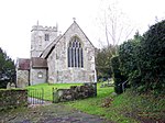
Sedgehill and Semley

Sedgehill and Semley is a civil parish in the English county of Wiltshire, about 3 miles (4.8 km) north of the town of Shaftesbury on the main A350 road. It is in the southwest of Wiltshire and adjoins Dorset. The parish includes the villages of Sedgehill and Semley, and the hamlets of Barkers Hill (in the southeast, towards Donhead St Andrew) and Sem Hill (near Semley). The population of the parish at the 2011 census was 601.The River Sem forms part of the northern boundary of the parish, and is fed by several streams which cross the parish in a generally northeasterly direction. The Sem joins the River Nadder in the northeast corner of the parish near Wardour, and the short eastern boundary of the parish follows the course of the Nadder.
Excerpt from the Wikipedia article Sedgehill and Semley (License: CC BY-SA 3.0, Authors, Images).Sedgehill and Semley
Geographical coordinates (GPS) Address Nearby Places Show on map
Geographical coordinates (GPS)
| Latitude | Longitude |
|---|---|
| N 51.045833333333 ° | E -2.1791666666667 ° |
Address
SP7 9JU , Sedgehill and Semley
England, United Kingdom
Open on Google Maps


