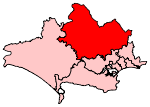
Higher Wincombe
Hamlets in WiltshireMilitary history of WiltshireUse British English from May 2021Wiltshire geography stubsY service
Higher Wincombe is a farm and small hamlet in the parish of Donhead St Mary, Wiltshire, England. It lies at the head of the Nadder Valley, just beyond the north-east edge of the town of Shaftesbury, Dorset and within the Cranborne Chase and West Wiltshire Downs Area of Outstanding Natural Beauty.
Excerpt from the Wikipedia article Higher Wincombe (License: CC BY-SA 3.0, Authors).Higher Wincombe
Wincombe Lane,
Geographical coordinates (GPS) Address Nearby Places Show on map
Geographical coordinates (GPS)
| Latitude | Longitude |
|---|---|
| N 51.01461 ° | E -2.17926 ° |
Address
Wincombe Lane
Wincombe Lane
SP7 8QF , The Maltings
England, United Kingdom
Open on Google Maps


